Waterway information

Kind:
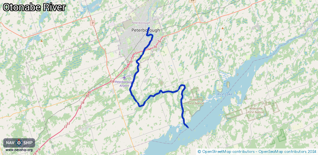
Inland
Driving areas:
🇨🇦 Canada
Length:
35.3 km¹
¹River kilometers or bank length recorded in NavShip, including river arms and harbor entrances.
Availability:
Completely recorded
Recent Update: 09.04.2025²
² This date indicates when an adjustment last took place in the course of the body of water
Recorded:
Locks: 1
Harbours / marinas: 3
Bridges: 0
Berths: 0
Slipways: 0
Fuelstations: 0
Route:
Please wait, loading route graphic...
Request waterway overview map with symbol legend here (Link).
Information about data associated with this body of water (3 available):
Data by OpenSeaMap (c) OSM contributors, www.openseamap.org
| # | Kind | Coordinates | Name | Information |
|---|---|---|---|---|
| 1 | Marina | 44.21546,-78.2335 | 2021-05-16T12:55:14Z | Campbelltown (Small Craft Harbour) |
| 2 | Marina | 44.20616,-78.27729 | 2021-05-16T12:52:06Z | Bensfort Bridge Resort |
| 3 | Marina | 44.29654,-78.31868 | 2024-02-07T02:49:19Z | |
| 3 | Marina | 44.29654,-78.31868 | 2024-02-07T02:49:19Z |