Waterway information

Kind:
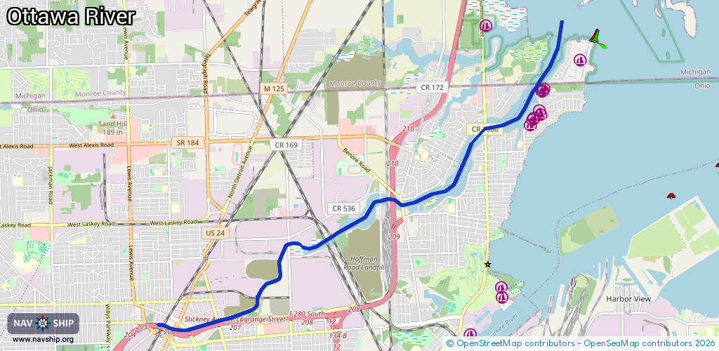
Inland
Driving areas:
🇺🇸 United States of America
Length:
11.8 km¹
¹River kilometers or bank length recorded in NavShip, including river arms and harbor entrances.
Availability:
Completely recorded
Recent Update: 30.06.2024²
² This date indicates when an adjustment last took place in the course of the body of water
Recorded:
Locks: 0
Harbours / marinas: 8
Bridges: 0
Berths: 0
Slipways: 0
Fuelstations: 0
Route:
Please wait, loading route graphic...
Request waterway overview map with symbol legend here (Link).
Information about data associated with this body of water (8 available):
Data by OpenSeaMap (c) OSM contributors, www.openseamap.org
| # | Kind | Coordinates | Name | Information |
|---|---|---|---|---|
| 1 | Marina | 41.72506,-83.4684 | 2026-02-13T22:19:51Z | Ottawa River Yacht Club |
| 2 | Marina | 41.72764,-83.46623 | 2026-02-13T22:19:51Z | River View Yacht Club |
| 3 | Marina | 41.72698,-83.46583 | 2024-06-25T00:20:14Z | Jolly Roger Sailing Club |
| 4 | Marina | 41.72622,-83.46753 | 2024-06-25T00:24:37Z | Point Place Boat Club |
| 5 | Marina | 41.72603,-83.46784 | 2026-02-13T22:19:51Z | Outings Unlimited |
| 6 | Marina | 41.73115,-83.4655 | 2026-02-13T22:19:51Z | Jockett's Marina |
| 7 | Marina | 41.73168,-83.46507 | 2026-02-13T22:19:51Z | Bush Marine |
| 8 | Marina | 41.73123,-83.46538 | 2024-06-25T00:17:14Z | Jockett's Marina |