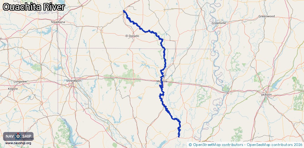
Waterway information

Kind:
Inland
Driving areas:
🇺🇸 United States of America
Length:
468.3 km¹
¹River kilometers or bank length recorded in NavShip, including river arms and harbor entrances.
Availability:
Completely recorded
Recent Update: 28.03.2024²
² This date indicates when an adjustment last took place in the course of the body of water
Recorded:
Locks: 3
Harbours / marinas: 0
Bridges: 0
Berths: 0
Slipways: 0
Fuelstations: 0
Route:
Please wait, loading route graphic...
Request waterway overview map with symbol legend here (Link).
Information about data associated with this body of water (1 available):
Data by OpenSeaMap (c) OSM contributors, www.openseamap.org
| # | Kind | Coordinates | Name | Information |
|---|---|---|---|---|
| 3 | Bridge | 52.08603,4.65957 | 8 | Clearance height: 2020-10-29T21:19:49Z m Maximum passage width: 1.5 m Movable bridge (e.g. lifting bridge or drawbridge) bascule |
| 1 | Lock | 33.05877,-92.12262 | Felsenthal Lock and Dam | |
| 1 | Lock | 33.05877,-92.12262 | Felsenthal Lock and Dam |