Waterway information

Kind:
Inland
Driving areas:
🌊 Atlantic Ocean🇮🇪 Ireland
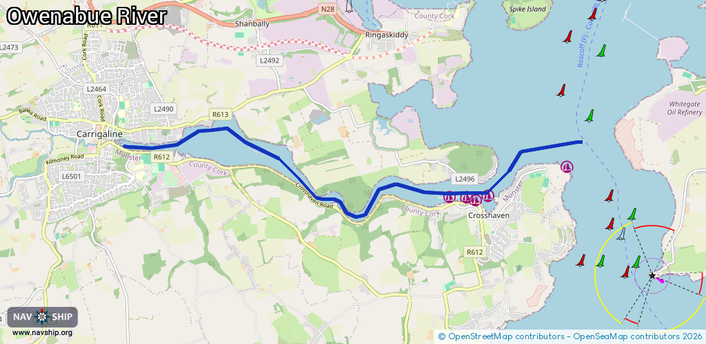
Length:
9.2 km¹
¹River kilometers or bank length recorded in NavShip, including river arms and harbor entrances.
Availability:
Completely recorded
Recent Update: 09.01.2024²
² This date indicates when an adjustment last took place in the course of the body of water
Recorded:
Locks: 0
Harbours / marinas: 5
Bridges: 0
Berths: 0
Slipways: 0
Fuelstations: 0
Route:
Please wait, loading route graphic...
Request waterway overview map with symbol legend here (Link).
Information about data associated with this body of water (5 available):
Data by OpenSeaMap (c) OSM contributors, www.openseamap.org
| # | Kind | Coordinates | Name | Information |
|---|---|---|---|---|
| 1 | Marina | 51.80509,-8.30544 | 2020-10-23T02:12:42Z | |
| 2 | Marina | 51.80465,-8.29869 | 2025-05-08T11:01:42Z | Hugh Coveney Pier Marina |
| 3 | Marina | 51.80515,-8.3007 | 2020-10-23T02:12:42Z | |
| 4 | Marina | 51.80539,-8.29554 | 2022-04-13T21:06:37Z | |
| 5 | Marina | 51.8098,-8.27593 | 2021-09-09T17:40:56Z | Inring Port Map 1880 Inring Port |