Waterway information

Kind:
Inland
Driving areas:
🌊 Baltic Sea🇵🇱 Poland🇷🇺 Russia
Length:
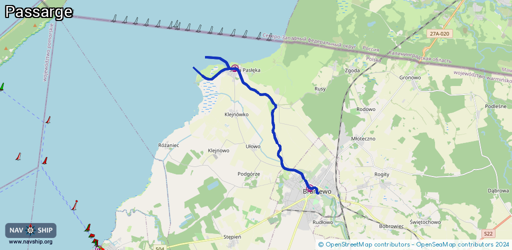
11.3 km¹
¹River kilometers or bank length recorded in NavShip, including river arms and harbor entrances.
Availability:
Completely recorded
Recent Update: 30.08.2021²
² This date indicates when an adjustment last took place in the course of the body of water
Recorded:
Locks: 0
Harbours / marinas: 2
Bridges: 0
Berths: 0
Slipways: 1
Fuelstations: 0
Route:
Please wait, loading route graphic...
Request waterway overview map with symbol legend here (Link).
Information about data associated with this body of water (3 available):
Data by OpenSeaMap (c) OSM contributors, www.openseamap.org
| # | Kind | Coordinates | Name | Information |
|---|---|---|---|---|
| 1 | Marina | 54.38382,19.82223 | 2022-08-31T08:03:31Z | |
| 2 | Marina | 54.43181,19.77065 | 2022-09-02T12:16:50Z | |
| 3 | Slipway | 54.43191,19.77001 | small_craft_facility | 2022-08-26T23:32:30Z |