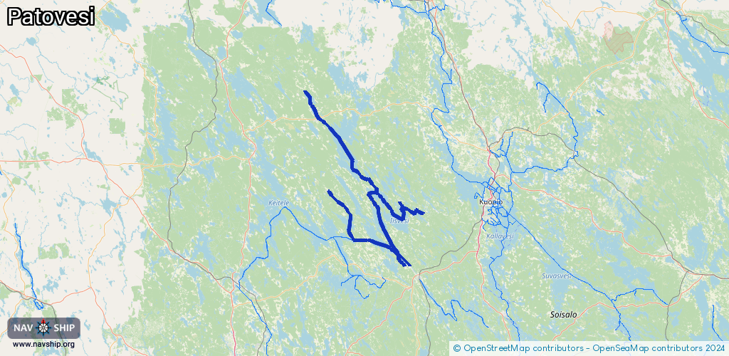
Waterway information

Kind:
Inland
Driving areas:
🇫🇮 Finland
Length:
173.9 km¹
¹River kilometers or bank length recorded in NavShip, including river arms and harbor entrances.
Availability:
Completely recorded
Recent Update: 06.06.2024²
² This date indicates when an adjustment last took place in the course of the body of water
Recorded:
Locks: 1
Harbours / marinas: 8
Bridges: 0
Berths: 0
Slipways: 0
Fuelstations: 0
Route:
Please wait, loading route graphic...
Request waterway overview map with symbol legend here (Link).
Information about data associated with this body of water (8 available):
Data by OpenSeaMap (c) OSM contributors, www.openseamap.org
| # | Kind | Coordinates | Name | Information |
|---|---|---|---|---|
| 1 | Marina | 62.6667,27.04886 | 2020-07-27T16:16:38Z | |
| 2 | Marina | 62.75876,26.69498 | 2024-06-17T15:25:45Z | Kerkonkosken satama |
| 3 | Marina | 62.92989,26.42309 | 2025-10-22T05:59:26Z | |
| 4 | Marina | 62.68151,26.98266 | 2023-04-17T17:40:35Z | |
| 5 | Marina | 62.68108,26.98326 | 2020-08-03T12:57:03Z | |
| 6 | Marina | 63.18051,26.35531 | 2022-05-13T18:26:54Z | |
| 7 | Marina | 62.85506,27.1534 | 2021-11-01T19:30:27Z | Syvänniemen venesatama |
| 8 | Marina | 62.88742,26.9726 | 2022-12-05T23:59:40Z | Paimelan venesatama |
| 8 | Marina | 62.88742,26.9726 | 2022-12-05T23:59:40Z | Paimelan venesatama |