Waterway information

Kind:
Inland
Driving areas:
🌊 Atlantic Ocean🇺🇸 United States of America
Length:
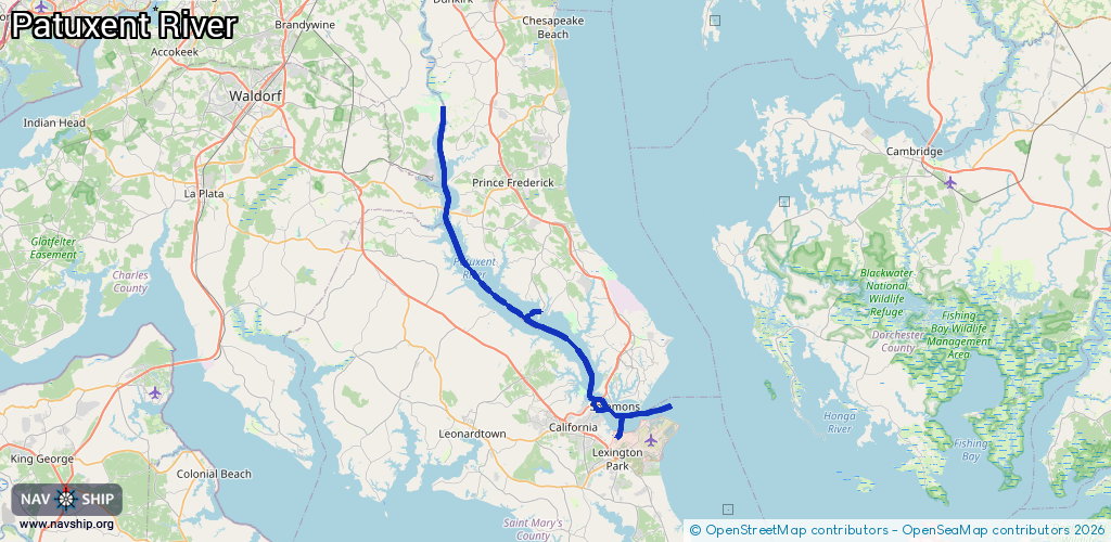
56.1 km¹
¹River kilometers or bank length recorded in NavShip, including river arms and harbor entrances.
Availability:
Completely recorded
Recent Update: 15.05.2025²
² This date indicates when an adjustment last took place in the course of the body of water
Recorded:
Locks: 0
Harbours / marinas: 16
Bridges: 4
Berths: 0
Slipways: 0
Fuelstations: 0
Route:
Please wait, loading route graphic...
Request waterway overview map with symbol legend here (Link).
Information about data associated with this body of water (20 available):
Data by OpenSeaMap (c) OSM contributors, www.openseamap.org
| # | Kind | Coordinates | Name | Information |
|---|---|---|---|---|
| 1 | Marina | 38.28954,-76.45328 | 2025-05-11T11:54:25Z | |
| 2 | Marina | 38.28928,-76.45204 | 2025-05-11T11:54:25Z | |
| 3 | Marina | 38.28947,-76.45198 | 2025-05-11T11:54:25Z | |
| 4 | Marina | 38.28964,-76.45192 | 2025-05-11T11:54:25Z | |
| 5 | Marina | 38.28966,-76.45324 | 2025-05-11T11:54:25Z | |
| 6 | Marina | 38.28983,-76.45185 | 2025-05-11T11:54:25Z | |
| 7 | Marina | 38.29,-76.45183 | 2025-05-11T11:54:25Z | |
| 8 | Marina | 38.29001,-76.45311 | 2025-05-11T11:54:25Z | |
| 9 | Marina | 38.29024,-76.45175 | 2025-05-11T11:54:25Z | |
| 10 | Marina | 38.29039,-76.45298 | 2025-05-11T11:54:25Z | |
| 11 | Marina | 38.2906,-76.45211 | 2025-05-11T11:54:25Z | |
| 12 | Marina | 38.29076,-76.45285 | 2025-05-11T11:54:25Z | |
| 13 | Marina | 38.29211,-76.45014 | 2025-05-11T11:58:46Z | |
| 14 | Marina | 38.29211,-76.45253 | 2025-05-11T11:58:46Z | |
| 15 | Marina | 38.29189,-76.4526 | 2025-05-11T11:58:46Z | |
| 16 | Marina | 38.41299,-76.54936 | 2022-03-07T05:30:59Z | |
| 17 | Bridge | 38.51381,-76.67181 | Unknown | Clearance height: 2025-12-14T20:23:33Z m Maximum passage width: 16 m Movable bridge (e.g. lifting bridge or drawbridge) fixed |
| 18 | Bridge | 38.51288,-76.66959 | Unknown | Clearance height: 2024-07-25T17:17:11Z m Maximum passage width: 16 m Movable bridge (e.g. lifting bridge or drawbridge) swing |
| 19 | Bridge | 38.32567,-76.47221 | 91.4 | Clearance height: 2023-05-14T20:42:18Z m Maximum passage width: 42.6 m Movable bridge (e.g. lifting bridge or drawbridge) fixed |
| 20 | Bridge | 38.31941,-76.48092 | 15.2 | Clearance height: 2023-05-18T02:48:06Z m Maximum passage width: 9.1 m Movable bridge (e.g. lifting bridge or drawbridge) fixed |