Waterway information

Kind:
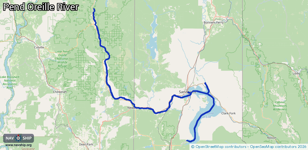
Inland
Driving areas:
🇺🇸 United States of America
Length:
205.4 km¹
¹River kilometers or bank length recorded in NavShip, including river arms and harbor entrances.
Availability:
Completely recorded
Recent Update: 24.09.2025²
² This date indicates when an adjustment last took place in the course of the body of water
Recorded:
Locks: 0
Harbours / marinas: 5
Bridges: 0
Berths: 0
Slipways: 2
Fuelstations: 0
Route:
Please wait, loading route graphic...
Request waterway overview map with symbol legend here (Link).
Information about data associated with this body of water (7 available):
Data by OpenSeaMap (c) OSM contributors, www.openseamap.org
| # | Kind | Coordinates | Name | Information |
|---|---|---|---|---|
| 1 | Marina | 47.97463,-116.54461 | 2023-06-21T16:46:52Z | |
| 2 | Marina | 48.28126,-116.35275 | 2025-08-26T17:30:57Z | |
| 3 | Marina | 48.27995,-116.3518 | 2025-08-26T17:30:57Z | |
| 4 | Marina | 48.27838,-116.3507 | 2025-08-26T17:30:57Z | |
| 5 | Marina | 48.27457,-116.54009 | 2018-03-04T14:12:03Z | Windbag Marina |
| 6 | Slipway | 48.27189,-116.5414 | Unknown | 2024-03-28T06:19:24Z |
| 7 | Slipway | 48.27189,-116.5414 | small_craft_facility | 2024-03-28T06:19:24Z |