Waterway information

Kind:
Inland
Driving areas:
🌊 Atlantic Ocean🇬🇧 United Kingdom
Length:
8.3 km¹
¹River kilometers or bank length recorded in NavShip, including river arms and harbor entrances.
Availability:
Completely recorded
Recent Update: 21.08.2023²
² This date indicates when an adjustment last took place in the course of the body of water
Recorded:
Locks: 0
Harbours / marinas: 5
Bridges: 0
Berths: 0
Slipways: 1
Fuelstations: 0
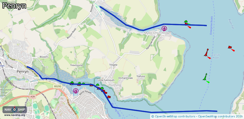
Route:
Please wait, loading route graphic...
Request waterway overview map with symbol legend here (Link).
Information about data associated with this body of water (6 available):
Data by OpenSeaMap (c) OSM contributors, www.openseamap.org
| # | Kind | Coordinates | Name | Information |
|---|---|---|---|---|
| 1 | Marina | 50.16351,-5.08465 | 2024-06-13T00:45:24Z | Falmouth Marina |
| 2 | Marina | 50.15387,-5.06562 | 2021-02-27T16:00:44Z | Falmouth Visiting Yacht Haven |
| 3 | Marina | 50.15213,-5.06141 | 2021-02-27T16:00:44Z | Port Pendennis Marina |
| 4 | Marina | 50.15103,-5.0605 | 2021-02-27T16:00:44Z | |
| 5 | Marina | 50.17845,-5.05239 | 2021-03-29T16:38:00Z | Mylor Yacht Harbour |
| 6 | Slipway | 50.15163,-5.05973 | small_craft_facility | 2024-02-13T09:04:08Z |