Waterway information

Kind:
Inland
Driving areas:
🌊 Baltic Sea🇵🇱 Poland
Length:
19.6 km¹
¹River kilometers or bank length recorded in NavShip, including river arms and harbor entrances.
Availability:
Completely recorded
Recent Update: 26.07.2023²
² This date indicates when an adjustment last took place in the course of the body of water
Recorded:
Locks: 0
Harbours / marinas: 2
Bridges: 0
Berths: 0
Slipways: 4
Fuelstations: 0
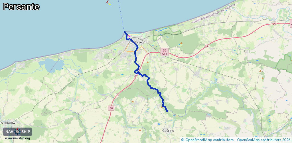
Route:
Please wait, loading route graphic...
Request waterway overview map with symbol legend here (Link).
Information about data associated with this body of water (6 available):
Data by OpenSeaMap (c) OSM contributors, www.openseamap.org
| # | Kind | Coordinates | Name | Information |
|---|---|---|---|---|
| 1 | Marina | 54.17856,15.56009 | 2018-11-27T22:17:24Z | Basen Solny Im. 100-Lecia Ligi Morskiej i Rzecznej customers |
| 2 | Marina | 54.17928,15.55936 | 2023-04-16T21:45:20Z | Yacht Club Kołobrzeg http://www.marinakolobrzeg.pl/ |
| 3 | Slipway | 54.09099,15.64171 | small_craft_facility | 2017-03-03T15:04:20Z |
| 4 | Slipway | 54.14661,15.57423 | small_craft_facility | 2017-03-03T15:04:22Z Zjazd do rzeki |
| 5 | Slipway | 54.17864,15.55769 | small_craft_facility | 2018-12-04T11:23:21Z |
| 6 | Slipway | 54.17931,15.55802 | small_craft_facility | 2020-04-29T06:11:35Z |