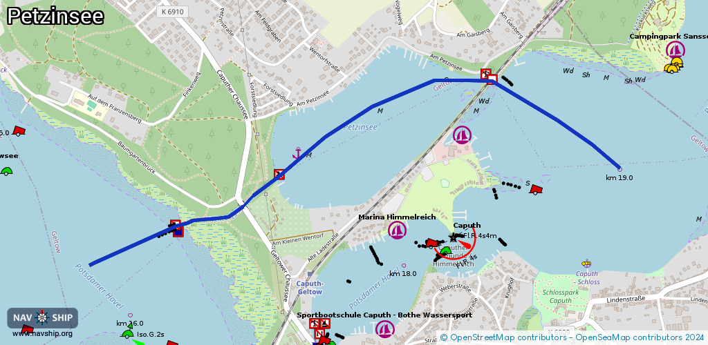
Waterway information

Kind:
Lower
Driving areas:
🇩🇪 Germany
Length:
2.6 km¹
¹River kilometers or bank length recorded in NavShip, including river arms and harbor entrances.
Availability:
Completely recorded
Recent Update: 09.07.2024²
² This date indicates when an adjustment last took place in the course of the body of water
Recorded:
Locks: 0
Harbours / marinas: 0
Bridges: 2
Berths: 2
Slipways: 0
Fuelstations: 0
Route:
Please wait, loading route graphic...
Request waterway overview map with symbol legend here (Link).
Information about data associated with this body of water (4 available):
Data by OpenSeaMap (c) OSM contributors, www.openseamap.org
| # | Kind | Coordinates | Name | Information |
|---|---|---|---|---|
| 1 | Bridge | 52.35296,12.9803 | Unknown | Clearance height: 2023-08-09T11:17:54Z m Maximum passage width: 2 m fixed |
| 2 | Bridge | 52.35776,12.99574 | 19.9 | Clearance height: 2023-09-18T07:05:38Z m Maximum passage width: 4 m Movable bridge (e.g. lifting bridge or drawbridge) fixed |
| 3 | Berth | 52.35491,12.98376 | 2023-08-14T16:42:12Z | |
| 4 | Berth | 52.35785,13.00356 | 2025-05-10T10:55:56Z |