Waterway information

Kind:
Inland
Driving areas:
🇩🇪 Germany
Length:
19.7 km¹
¹River kilometers or bank length recorded in NavShip, including river arms and harbor entrances.
Availability:
Completely recorded
Recent Update: 31.03.2025²
² This date indicates when an adjustment last took place in the course of the body of water
Recorded:
Locks: 1
Harbours / marinas: 5
Bridges: 4
Berths: 0
Slipways: 2
Fuelstations: 0
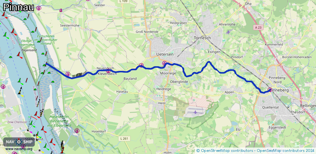
Route:
Please wait, loading route graphic...
Request waterway overview map with symbol legend here (Link).
Information about data associated with this body of water (12 available):
Data by OpenSeaMap (c) OSM contributors, www.openseamap.org
| # | Kind | Coordinates | Name | Information |
|---|---|---|---|---|
| 1 | Marina | 53.66166,9.78689 | 2023-11-10T12:32:05Z | Pinneberger Motorbootclub +49 4101 5850098 http://pinneberger-motorbootclub.de |
| 2 | Marina | 53.67913,9.66931 | 2018-08-07T02:27:42Z | Stichhafen Uetersen Immer eine Reise wert [email protected] http://www.wsv-uetersen.de |
| 3 | Marina | 53.67773,9.64412 | 2025-12-30T12:03:29Z | Hafen Klosterdeich [email protected] http://www.wsv-uetersen.de/ |
| 4 | Marina | 53.67394,9.60673 | 2022-10-17T06:11:25Z | Moorreger Wassersportverein +49 172 4511457 https://www.moorreger-wassersportverein.de/ |
| 5 | Marina | 53.67199,9.56187 | 2018-06-13T13:23:35Z | Seglervereinigung Pinnau [email protected] +49 40 67958068 http://www.sv-pinnau.de/ |
| 6 | Bridge | 53.66158,9.78659 | Unknown | Clearance height: 2013-06-02T08:37:37Z m fixed |
| 7 | Bridge | 53.67873,9.68009 | Unknown | Clearance height: 2013-01-09T11:42:32Z m fixed |
| 8 | Bridge | 53.67825,9.67724 | Unknown | Clearance height: 2013-01-09T11:42:33Z m fixed |
| 9 | Bridge | 53.67466,9.6082 | Unknown | Clearance height: 2019-10-03T19:38:23Z m Movable bridge (e.g. lifting bridge or drawbridge) fixed |
| 10 | Slipway | 53.67771,9.64266 | small_craft_facility | 2013-01-09T11:42:25Z |
| 11 | Slipway | 53.67387,9.60696 | small_craft_facility | 2015-12-25T23:12:44Z |
| 12 | Lock | 53.67117,9.55835 | Unknown |