Waterway information

Kind:
Inland
Driving areas:
🇵🇱 Poland
Length:
87.4 km¹
¹River kilometers or bank length recorded in NavShip, including river arms and harbor entrances.
Availability:
Completely recorded
Recent Update: 03.04.2025²
² This date indicates when an adjustment last took place in the course of the body of water
Recorded:
Locks: 0
Harbours / marinas: 4
Bridges: 3
Berths: 0
Slipways: 0
Fuelstations: 0
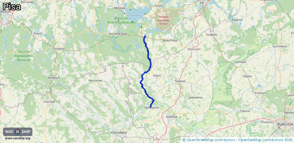
Route:
Please wait, loading route graphic...
Request waterway overview map with symbol legend here (Link).
Information about data associated with this body of water (7 available):
Data by OpenSeaMap (c) OSM contributors, www.openseamap.org
| # | Kind | Coordinates | Name | Information |
|---|---|---|---|---|
| 1 | Marina | 53.63885,21.81689 | 2023-11-10T06:07:43Z | Hotel Roś +48 874 234 960 https://www.hotelros.pl/ |
| 2 | Marina | 53.63445,21.81672 | 2025-12-04T12:32:38Z | PMOS Pisz +48 87 423 45 72 https://www.pmos.pisz.pl/ |
| 3 | Marina | 53.63134,21.81013 | 2025-12-04T10:48:20Z | |
| 4 | Marina | 53.6314,21.81 | 2025-12-02T13:48:39Z | |
| 5 | Bridge | 53.63158,21.81179 | Unknown | Clearance height: 2016-11-22T09:59:11Z m Maximum passage width: 4.5 m fixed |
| 6 | Bridge | 53.43067,21.83067 | 20 | Clearance height: 2017-01-23T20:23:56Z m Maximum passage width: 4 m fixed |
| 7 | Bridge | 53.43067,21.83067 | 20 | Clearance height: 2025-06-03T05:49:21Z m Maximum passage width: 4 m fixed |