Waterway information

Kind:
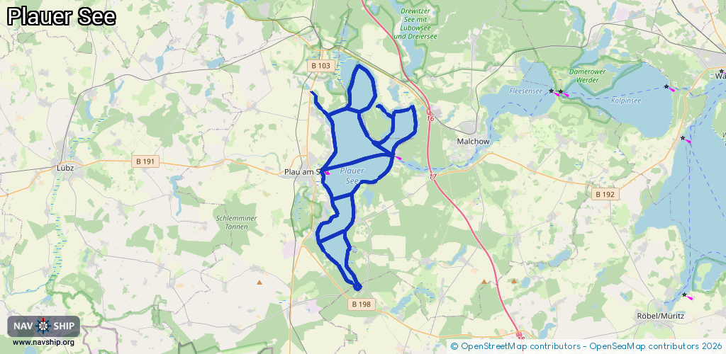
Lake
Driving areas:
🇩🇪 Germany
Length:
56.1 km¹
¹River kilometers or bank length recorded in NavShip, including river arms and harbor entrances.
Availability:
Completely recorded
Recent Update: 22.02.2026²
² This date indicates when an adjustment last took place in the course of the body of water
Recorded:
Locks: 0
Harbours / marinas: 4
Bridges: 0
Berths: 0
Slipways: 1
Fuelstations: 0
Route:
Please wait, loading route graphic...
Request waterway overview map with symbol legend here (Link).
Information about data associated with this body of water (5 available):
Data by OpenSeaMap (c) OSM contributors, www.openseamap.org
| # | Kind | Coordinates | Name | Information |
|---|---|---|---|---|
| 1 | Marina | 53.44985,12.31043 | 2023-08-29T01:31:56Z | Marina Zwei Seen https://www.zweiseen.de/von-a-z/marina-bootsverleih/ |
| 2 | Marina | 53.39032,12.31321 | 2025-06-27T11:23:10Z | Marina Bad Stuer |
| 3 | Marina | 53.45415,12.27668 | 2025-08-12T14:53:55Z | Marina Plau am See +49 38735 45539 https://segelschule-plau.de/ |
| 4 | Marina | 53.51279,12.32999 | 2017-04-26T09:00:46Z | |
| 5 | Slipway | 53.45337,12.27616 | small_craft_facility | 2013-05-12T15:21:58Z |