Waterway information

Kind:
Lake
Driving areas:
🇩🇪 Germany
Length:
41.8 km¹
¹River kilometers or bank length recorded in NavShip, including river arms and harbor entrances.
Availability:
Completely recorded
Recent Update: 22.02.2026²
² This date indicates when an adjustment last took place in the course of the body of water
Recorded:
Locks: 0
Harbours / marinas: 5
Bridges: 0
Berths: 0
Slipways: 2
Fuelstations: 0
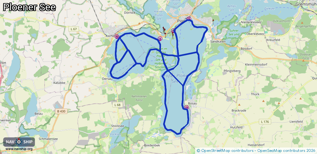
Route:
Please wait, loading route graphic...
Request waterway overview map with symbol legend here (Link).
Information about data associated with this body of water (7 available):
Data by OpenSeaMap (c) OSM contributors, www.openseamap.org
| # | Kind | Coordinates | Name | Information |
|---|---|---|---|---|
| 1 | Marina | 54.15142,10.40885 | 2022-08-05T21:21:26Z | Schüler Ruder- und Segelverein Plön |
| 2 | Marina | 54.15944,10.42594 | 2023-05-22T18:09:50Z | Plöner Segler-Verein von 1908 e.V. |
| 3 | Marina | 54.14636,10.39407 | 2016-06-07T16:29:47Z | Plön |
| 4 | Marina | 54.10162,10.42371 | 2022-09-05T10:21:07Z | Bosau |
| 5 | Marina | 54.14793,10.34598 | 2019-08-02T18:10:26Z | Ascheberg |
| 6 | Slipway | 54.15345,10.38367 | small_craft_facility | 2016-06-07T16:29:50Z |
| 7 | Slipway | 54.14785,10.34547 | small_craft_facility | 2021-06-24T13:17:08Z |