Waterway information

Kind:
Inland
Driving areas:
🇮🇹 Italy🌊 Sea Mediterranean
Length:
30.6 km¹
¹River kilometers or bank length recorded in NavShip, including river arms and harbor entrances.
Availability:
Completely recorded
Recent Update: 07.08.2023²
² This date indicates when an adjustment last took place in the course of the body of water
Recorded:
Locks: 0
Harbours / marinas: 4
Bridges: 0
Berths: 0
Slipways: 1
Fuelstations: 0
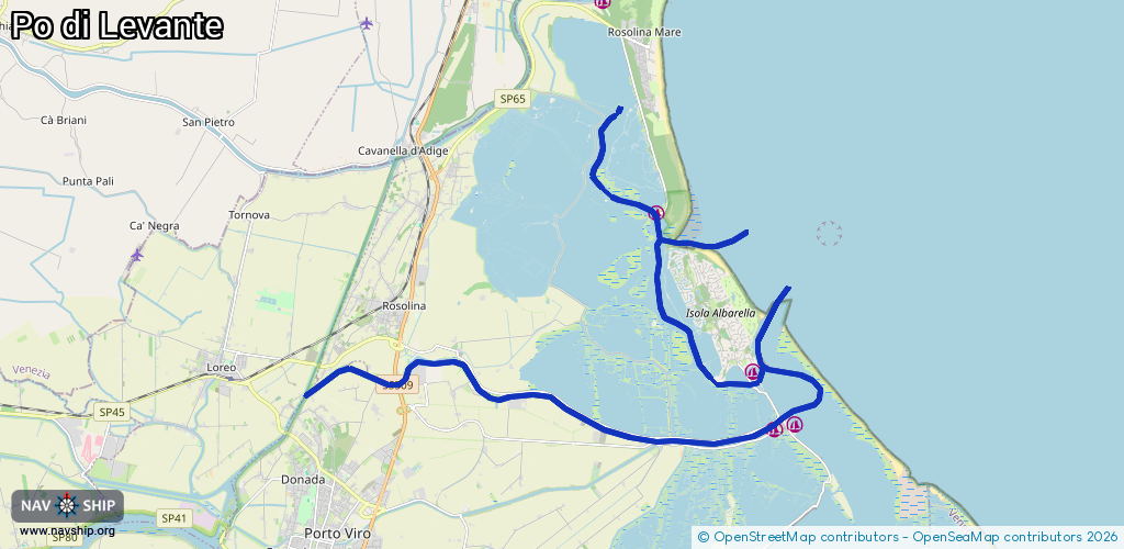
Route:
Please wait, loading route graphic...
Request waterway overview map with symbol legend here (Link).
Information about data associated with this body of water (5 available):
Data by OpenSeaMap (c) OSM contributors, www.openseamap.org
| # | Kind | Coordinates | Name | Information |
|---|---|---|---|---|
| 1 | Marina | 45.04828,12.36203 | 2023-10-27T16:29:45Z | |
| 2 | Marina | 45.04925,12.3683 | 2023-11-11T11:28:50Z | Marina di Porto Levante [email protected] +39 0426 666047 https://www.marinadiportolevante.it/ |
| 3 | Marina | 45.096,12.32497 | 2023-05-21T13:29:32Z | Porto Caleri |
| 4 | Marina | 45.06131,12.35552 | 2019-03-21T07:05:53Z | Marina di Albarella [email protected] +39 426 332262 https://www.albarella.it/porto |
| 5 | Slipway | 45.062,12.35523 | small_craft_facility | 2018-12-09T01:07:50Z |