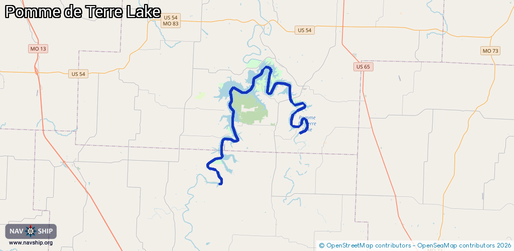
Waterway information

Kind:
Inland
Driving areas:
🇺🇸 United States of America
Length:
41.1 km¹
¹River kilometers or bank length recorded in NavShip, including river arms and harbor entrances.
Availability:
Completely recorded
Recent Update: 29.01.2025²
² This date indicates when an adjustment last took place in the course of the body of water
Recorded:
Locks: 0
Harbours / marinas: 5
Bridges: 0
Berths: 0
Slipways: 0
Fuelstations: 0
Route:
Please wait, loading route graphic...
Request waterway overview map with symbol legend here (Link).
Information about data associated with this body of water (5 available):
Data by OpenSeaMap (c) OSM contributors, www.openseamap.org
| # | Kind | Coordinates | Name | Information |
|---|---|---|---|---|
| 1 | Marina | 37.85227,-93.35377 | 2025-01-25T13:20:50Z | |
| 2 | Marina | 37.85731,-93.36032 | 2025-01-25T13:20:50Z | |
| 3 | Marina | 37.86633,-93.34984 | 2025-01-25T13:20:50Z | |
| 4 | Marina | 37.89478,-93.32338 | 2025-01-25T13:20:50Z | |
| 5 | Marina | 37.87605,-93.31576 | 2025-02-11T02:15:46Z | Pomme De Terre State Park Marina |