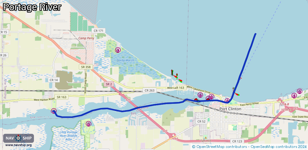
Waterway information

Kind:
Inland
Driving areas:
🇺🇸 United States of America
Length:
12.2 km¹
¹River kilometers or bank length recorded in NavShip, including river arms and harbor entrances.
Availability:
Completely recorded
Recent Update: 01.12.2023²
² This date indicates when an adjustment last took place in the course of the body of water
Recorded:
Locks: 0
Harbours / marinas: 6
Bridges: 0
Berths: 0
Slipways: 1
Fuelstations: 0
Route:
Please wait, loading route graphic...
Request waterway overview map with symbol legend here (Link).
Information about data associated with this body of water (7 available):
Data by OpenSeaMap (c) OSM contributors, www.openseamap.org
| # | Kind | Coordinates | Name | Information |
|---|---|---|---|---|
| 1 | Marina | 41.51535,-82.93939 | 2015-10-11T07:52:28Z | Port Clinton Yacht Club |
| 2 | Marina | 41.51718,-82.94847 | 2015-10-11T07:52:28Z | Brands Marina |
| 3 | Marina | 41.51628,-82.95016 | 2015-10-11T07:52:28Z | Harborside |
| 4 | Marina | 41.51784,-82.95484 | 2015-10-11T07:52:28Z | Clinton Reef Marina |
| 5 | Marina | 41.50548,-83.01898 | 2024-08-20T22:18:29Z | |
| 6 | Marina | 41.51102,-83.03854 | 2022-09-10T00:10:03Z | Portage View |
| 7 | Slipway | 41.51132,-83.03933 | Unknown | 2022-09-10T00:10:03Z |