Waterway information

Kind:
Inland
Driving areas:
🇧🇪 Belgium
Length:
6.7 km¹
¹River kilometers or bank length recorded in NavShip, including river arms and harbor entrances.
Availability:
Completely recorded
Recent Update: 05.09.2022²
² This date indicates when an adjustment last took place in the course of the body of water
Recorded:
Locks: 0
Harbours / marinas: 2
Bridges: 7
Berths: 0
Slipways: 0
Fuelstations: 0
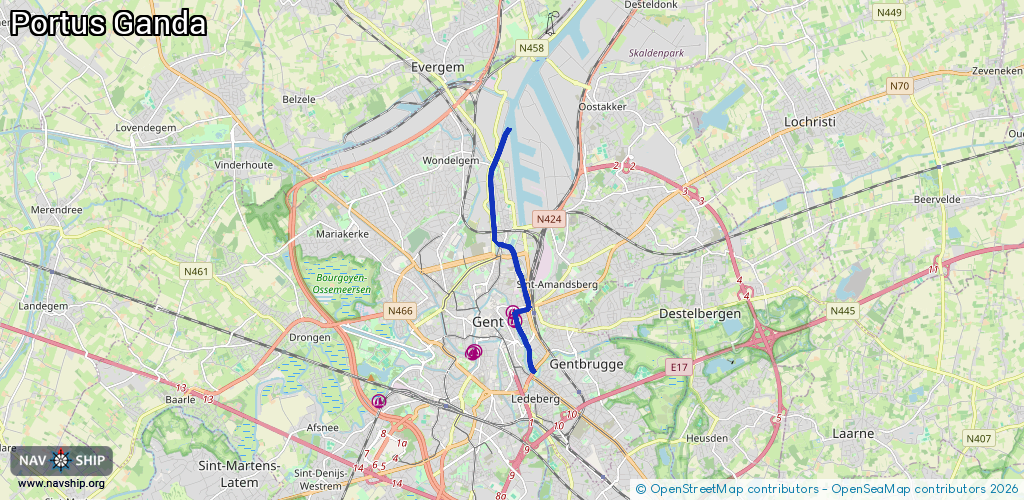
Route:
Please wait, loading route graphic...
Request waterway overview map with symbol legend here (Link).
Information about data associated with this body of water (9 available):
Data by OpenSeaMap (c) OSM contributors, www.openseamap.org
| # | Kind | Coordinates | Name | Information |
|---|---|---|---|---|
| 1 | Marina | 51.05389,3.73432 | 2019-01-02T14:55:38Z | Portus Ganda +32 9 266 56 60 |
| 2 | Marina | 51.05575,3.73358 | 2019-01-02T14:55:37Z | Portus Ganda +32 9 266 56 60 http://www.portusganda.be/ |
| 3 | Bridge | 51.05324,3.7351 | Unknown | Clearance height: 2018-04-24T22:15:41Z m Movable bridge (e.g. lifting bridge or drawbridge) fixed |
| 4 | Bridge | 51.05318,3.73452 | Unknown | Clearance height: 2018-08-12T15:29:16Z m Maximum passage width: 1.2 m Movable bridge (e.g. lifting bridge or drawbridge) fixed |
| 5 | Bridge | 51.06471,3.73548 | Unknown | Clearance height: 2018-12-19T17:03:58Z m Maximum passage width: 1.8 m Movable bridge (e.g. lifting bridge or drawbridge) lifting |
| 6 | Bridge | 51.06794,3.73396 | Unknown | Clearance height: 2025-08-28T12:24:38Z m Movable bridge (e.g. lifting bridge or drawbridge) fixed |
| 7 | Bridge | 51.07036,3.73028 | 19.2 | Clearance height: 2023-02-28T10:07:21Z m Maximum passage width: 4.78 m Movable bridge (e.g. lifting bridge or drawbridge) swing |
| 8 | Bridge | 51.07314,3.72696 | 16 | Clearance height: 2021-03-16T13:47:04Z m Maximum passage width: 1.41 m Movable bridge (e.g. lifting bridge or drawbridge) swing 5 |
| 9 | Bridge | 51.08843,3.72734 | 16 | Clearance height: 2023-02-28T10:07:33Z m Maximum passage width: 5.2 m Movable bridge (e.g. lifting bridge or drawbridge) opening 4 |