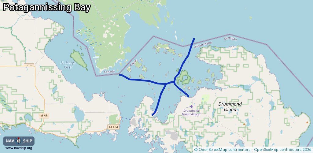
Waterway information

Kind:
Inland
Driving areas:
🇨🇦 Canada🇺🇸 United States of America
Length:
27.9 km¹
¹River kilometers or bank length recorded in NavShip, including river arms and harbor entrances.
Availability:
Completely recorded
Recent Update: 02.08.2025²
² This date indicates when an adjustment last took place in the course of the body of water
Recorded:
Locks: 0
Harbours / marinas: 2
Bridges: 0
Berths: 0
Slipways: 0
Fuelstations: 1
Route:
Please wait, loading route graphic...
Request waterway overview map with symbol legend here (Link).
Information about data associated with this body of water (3 available):
Data by OpenSeaMap (c) OSM contributors, www.openseamap.org
| # | Kind | Coordinates | Name | Information |
|---|---|---|---|---|
| 1 | Marina | 46.02432,-83.74955 | 2022-10-19T10:21:56Z | Drummond Island Yacht Haven +1 906 493 5232 https://www.diyachthaven.com/ |
| 2 | Marina | 46.00187,-83.82496 | 2025-07-24T05:13:23Z | Nates Landing & Marina +1 906 493 5352 |
| 3 | Fuel station | 46.02561,-83.74874 | 2023-07-12T18:31:22Z |