Waterway information

Kind:
Inland
Driving areas:
🇺🇸 United States of America
Length:
13.4 km¹
¹River kilometers or bank length recorded in NavShip, including river arms and harbor entrances.
Availability:
Completely recorded
Recent Update: 06.11.2025²
² This date indicates when an adjustment last took place in the course of the body of water
Recorded:
Locks: 0
Harbours / marinas: 6
Bridges: 0
Berths: 0
Slipways: 0
Fuelstations: 0
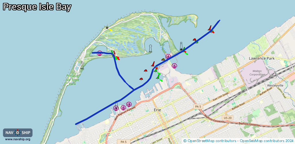
Route:
Please wait, loading route graphic...
Request waterway overview map with symbol legend here (Link).
Information about data associated with this body of water (6 available):
Data by OpenSeaMap (c) OSM contributors, www.openseamap.org
| # | Kind | Coordinates | Name | Information |
|---|---|---|---|---|
| 1 | Marina | 42.13015,-80.10997 | 2020-12-06T20:08:40Z | Perry's Landing Marina |
| 2 | Marina | 42.13039,-80.10559 | 2015-10-07T08:24:51Z | Bay Harbor Marina |
| 3 | Marina | 42.13193,-80.10222 | 2015-10-07T08:24:51Z | Bay Harbor - East Basin Marina |
| 4 | Marina | 42.15311,-80.07897 | 2024-07-05T16:43:21Z | Coast Guard Basin |
| 5 | Marina | 42.14857,-80.07542 | 2022-03-11T22:41:11Z | Lampe Marina https://www.porterie.org/lampemarina/ |
| 6 | Marina | 42.15447,-80.11973 | 2020-11-23T15:07:16Z | Presque Isle State Park Marina |