Waterway information

Kind:
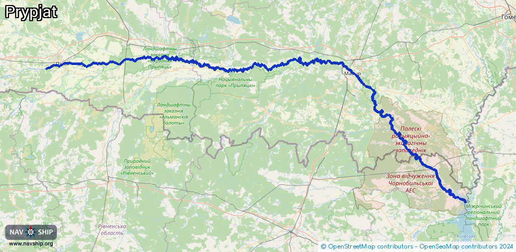
Inland
Driving areas:
🇧🇾 Belarus🇺🇦 Ukraine
Length:
528.3 km¹
¹River kilometers or bank length recorded in NavShip, including river arms and harbor entrances.
Availability:
Completely recorded
Recent Update: 03.04.2025²
² This date indicates when an adjustment last took place in the course of the body of water
Recorded:
Locks: 2
Harbours / marinas: 2
Bridges: 0
Berths: 0
Slipways: 0
Fuelstations: 0
Route:
Please wait, loading route graphic...
Request waterway overview map with symbol legend here (Link).
Information about data associated with this body of water (4 available):
Data by OpenSeaMap (c) OSM contributors, www.openseamap.org
| # | Kind | Coordinates | Name | Information |
|---|---|---|---|---|
| 1 | Marina | 52.10882,26.10594 | 2025-03-04T03:18:04Z | Кааператыў Лодачнік |
| 2 | Marina | 51.41038,30.09036 | 2023-10-29T15:06:08Z | Прип'ятський вантажний порт |
| 3 | Lock | 52.11608,26.43003 | Gidrouzel Kachanovichi | |
| 4 | Lock | 52.11505,26.73707 | Unknown |