Waterway information

Kind:
Inland
Driving areas:
🇨🇱 Chile
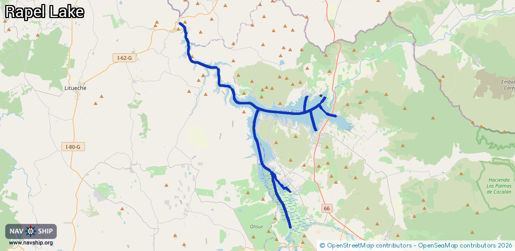
Length:
54.1 km¹
¹River kilometers or bank length recorded in NavShip, including river arms and harbor entrances.
Availability:
Completely recorded
Recent Update: 01.11.2024²
² This date indicates when an adjustment last took place in the course of the body of water
Recorded:
Locks: 0
Harbours / marinas: 8
Bridges: 0
Berths: 0
Slipways: 0
Fuelstations: 0
Route:
Please wait, loading route graphic...
Request waterway overview map with symbol legend here (Link).
Information about data associated with this body of water (8 available):
Data by OpenSeaMap (c) OSM contributors, www.openseamap.org
| # | Kind | Coordinates | Name | Information |
|---|---|---|---|---|
| 1 | Marina | -34.16463,-71.40112 | 2022-04-04T04:59:03Z | Club Náutico Rapel |
| 2 | Marina | -34.15074,-71.45348 | 2023-03-23T17:15:24Z | Puerto Deportivo Marina Rapel |
| 3 | Marina | -34.11457,-71.52407 | 2021-07-06T01:47:14Z | Marina La Puntilla |
| 4 | Marina | -34.05183,-71.57828 | 2023-04-04T03:59:48Z | |
| 5 | Marina | -34.04778,-71.58259 | 2021-07-06T04:05:20Z | Bahía Atenas |
| 6 | Marina | -34.12413,-71.41236 | 2021-06-07T03:04:49Z | Puerto Coipo |
| 7 | Marina | -34.14583,-71.38013 | 2022-04-04T04:59:03Z | Lago Rapel |
| 8 | Marina | -34.23167,-71.43729 | 2022-04-04T04:23:01Z | Club de Yates Santiago |