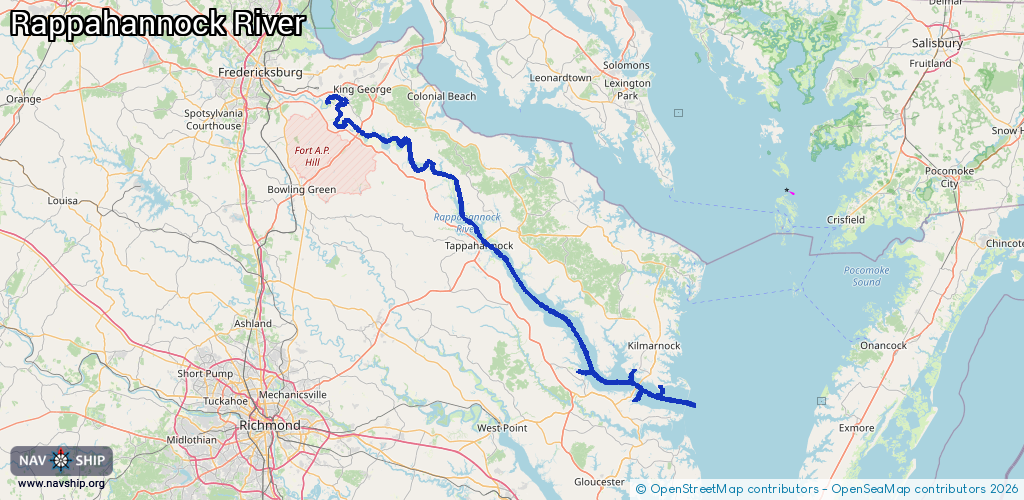
Waterway information

Kind:
Inland
Driving areas:
🌊 Atlantic Ocean🇺🇸 United States of America
Length:
160.9 km¹
¹River kilometers or bank length recorded in NavShip, including river arms and harbor entrances.
Availability:
Completely recorded
Recent Update: 03.04.2025²
² This date indicates when an adjustment last took place in the course of the body of water
Recorded:
Locks: 0
Harbours / marinas: 7
Bridges: 0
Berths: 1
Slipways: 1
Fuelstations: 0
Route:
Please wait, loading route graphic...
Request waterway overview map with symbol legend here (Link).
Information about data associated with this body of water (9 available):
Data by OpenSeaMap (c) OSM contributors, www.openseamap.org
| # | Kind | Coordinates | Name | Information |
|---|---|---|---|---|
| 1 | Marina | 37.6541,-76.59119 | 2020-05-19T21:33:26Z | Sunset Pointe Marina |
| 2 | Marina | 37.65249,-76.58739 | 2020-11-29T19:30:16Z | Boat Ramp & Docks |
| 3 | Marina | 37.65715,-76.43402 | 2022-06-28T09:35:20Z | Rappahannock Yachts Inc |
| 4 | Marina | 37.65974,-76.4409 | 2024-01-30T16:17:17Z | Ampro Shipyard |
| 5 | Marina | 37.65817,-76.43326 | 2020-05-19T21:33:26Z | Rappahannock Yachts |
| 6 | Marina | 37.62409,-76.36247 | 2022-08-15T09:45:11Z | |
| 7 | Marina | 37.59095,-76.43441 | 2022-08-15T09:54:47Z | Regent Point Marina |
| 8 | Slipway | 37.6526,-76.5874 | Unknown | 2020-11-29T19:30:16Z |
| 9 | Berth | 37.65974,-76.4409 | 2024-01-30T16:17:17Z | Ampro Shipyard marina |