Waterway information

Kind:
Inland
Driving areas:
🌊 Atlantic Ocean🇺🇸 United States of America
Length:
31.7 km¹
¹River kilometers or bank length recorded in NavShip, including river arms and harbor entrances.
Availability:
Completely recorded
Recent Update: 06.02.2024²
² This date indicates when an adjustment last took place in the course of the body of water
Recorded:
Locks: 0
Harbours / marinas: 4
Bridges: 6
Berths: 2
Slipways: 0
Fuelstations: 0
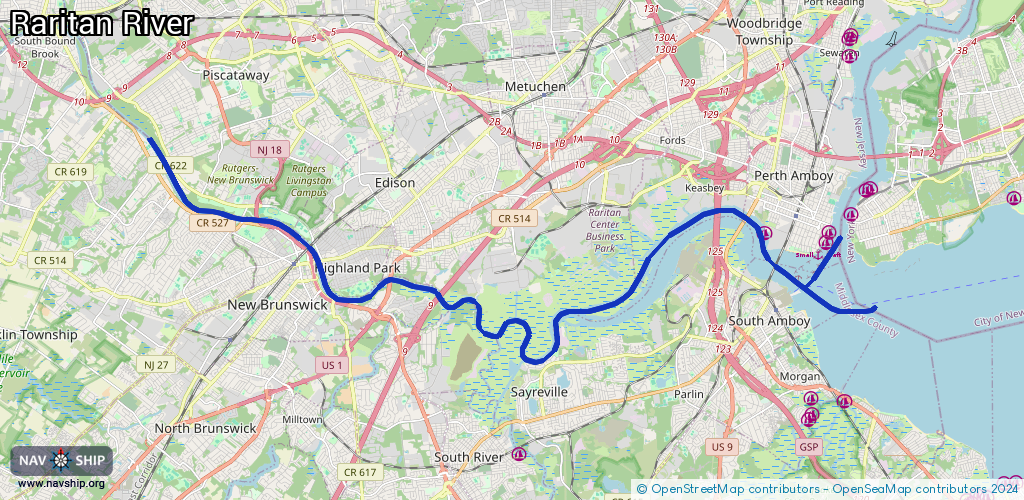
Route:
Please wait, loading route graphic...
Request waterway overview map with symbol legend here (Link).
Information about data associated with this body of water (12 available):
Data by OpenSeaMap (c) OSM contributors, www.openseamap.org
| # | Kind | Coordinates | Name | Information |
|---|---|---|---|---|
| 1 | Marina | 40.50233,-74.26345 | 2022-10-06T18:13:16Z | |
| 2 | Marina | 40.50477,-74.26241 | 2022-10-06T18:13:16Z | Perth Amboy Harborside Marina |
| 3 | Marina | 40.49342,-74.40993 | 2025-07-09T03:19:45Z | Raritan River Boat Club http://raritanriverboatclub.com/ |
| 4 | Marina | 40.50536,-74.28443 | 2020-12-09T03:02:25Z | Cornucopia Cruise Line https://cornucopiacruise.com/ |
| 5 | Bridge | 40.4883,-74.39632 | 45.7 | Clearance height: 2026-01-04T01:07:15Z m Maximum passage width: 13.7 m Movable bridge (e.g. lifting bridge or drawbridge) fixed |
| 6 | Bridge | 40.5107,-74.30044 | 60 | Clearance height: 2026-01-04T01:07:15Z m Maximum passage width: 33.5 m Movable bridge (e.g. lifting bridge or drawbridge) fixed |
| 7 | Bridge | 40.51072,-74.30116 | 58.8 | Clearance height: 2026-01-04T01:07:15Z m Maximum passage width: 40.8 m Movable bridge (e.g. lifting bridge or drawbridge) fixed |
| 8 | Bridge | 40.51068,-74.30018 | 60 | Clearance height: 2026-01-04T01:07:15Z m Maximum passage width: 33.5 m Movable bridge (e.g. lifting bridge or drawbridge) fixed |
| 9 | Bridge | 40.50793,-74.29163 | 107.8 | Clearance height: 2026-01-04T01:07:15Z m Maximum passage width: 33.5 m fixed |
| 10 | Bridge | 40.49663,-74.28066 | 37.7 | Clearance height: 2026-01-04T01:07:15Z m Maximum passage width: 2.4 m Movable bridge (e.g. lifting bridge or drawbridge) swing |
| 11 | Berth | 40.50135,-74.26443 | 2022-10-06T18:13:16Z | small_craft |
| 12 | Berth | 40.48736,-74.25668 | 2026-01-03T09:54:12Z | Ward Point Anchorage Buoy A anchorage |