Waterway information

Kind:
Lower
Driving areas:
🇩🇪 Germany
Length:
16.8 km¹
¹River kilometers or bank length recorded in NavShip, including river arms and harbor entrances.
Availability:
Completely recorded
Recent Update: 29.06.2023²
² This date indicates when an adjustment last took place in the course of the body of water
Recorded:
Locks: 0
Harbours / marinas: 5
Bridges: 0
Berths: 0
Slipways: 1
Fuelstations: 0
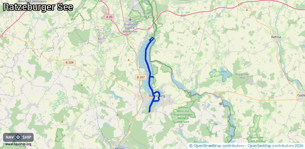
Route:
Please wait, loading route graphic...
Request waterway overview map with symbol legend here (Link).
Information about data associated with this body of water (6 available):
Data by OpenSeaMap (c) OSM contributors, www.openseamap.org
| # | Kind | Coordinates | Name | Information |
|---|---|---|---|---|
| 1 | Marina | 53.72699,10.76571 | 2013-01-11T15:53:35Z | Segler-Gemeinschaft Schwarzenbek - Kalkhütte [email protected] +49 4155 499852 https://www.sgs85.de/ |
| 2 | Marina | 53.77913,10.76025 | 2021-05-16T15:39:14Z | SVW |
| 3 | Marina | 53.77861,10.75911 | 2021-05-16T15:36:51Z | SCH |
| 4 | Marina | 53.70505,10.77589 | 2023-07-24T13:08:36Z | Ratzeburger Segler-Verein Osthafen [email protected] +49 4541 4797 https://ratzeburger-segler-verein.de/ |
| 5 | Marina | 53.70221,10.77167 | 2025-03-26T16:53:10Z | |
| 6 | Slipway | 53.70711,10.76646 | small_craft_facility | 2014-01-28T17:33:32Z |