Waterway information

Kind:
Lower
Driving areas:
🇩🇪 Germany
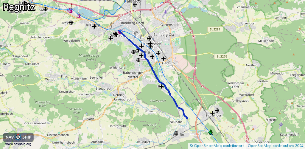
Length:
9.6 km¹
¹River kilometers or bank length recorded in NavShip, including river arms and harbor entrances.
Availability:
Completely recorded
Recent Update: 27.02.2026²
² This date indicates when an adjustment last took place in the course of the body of water
Recorded:
Locks: 2
Harbours / marinas: 1
Bridges: 0
Berths: 0
Slipways: 0
Fuelstations: 0
Route:
Please wait, loading route graphic...
Request waterway overview map with symbol legend here (Link).
Information about data associated with this body of water (3 available):
Data by OpenSeaMap (c) OSM contributors, www.openseamap.org
| # | Kind | Coordinates | Name | Information |
|---|---|---|---|---|
| 1 | Marina | 49.90595,10.86201 | 2015-09-27T21:23:59Z | Motorbootclub Regnitz-Main Bamberg [email protected] +49 951 62648 |
| 2 | Lock | 49.9015,10.86945 | Unknown | |
| 3 | Lock | 49.88783,10.89026 | Schleuse 100 Ludwig-Donau-Main-Kanal | 09512976200 |