Waterway information

Kind:
Inland
Driving areas:
🇷🇺 Russia
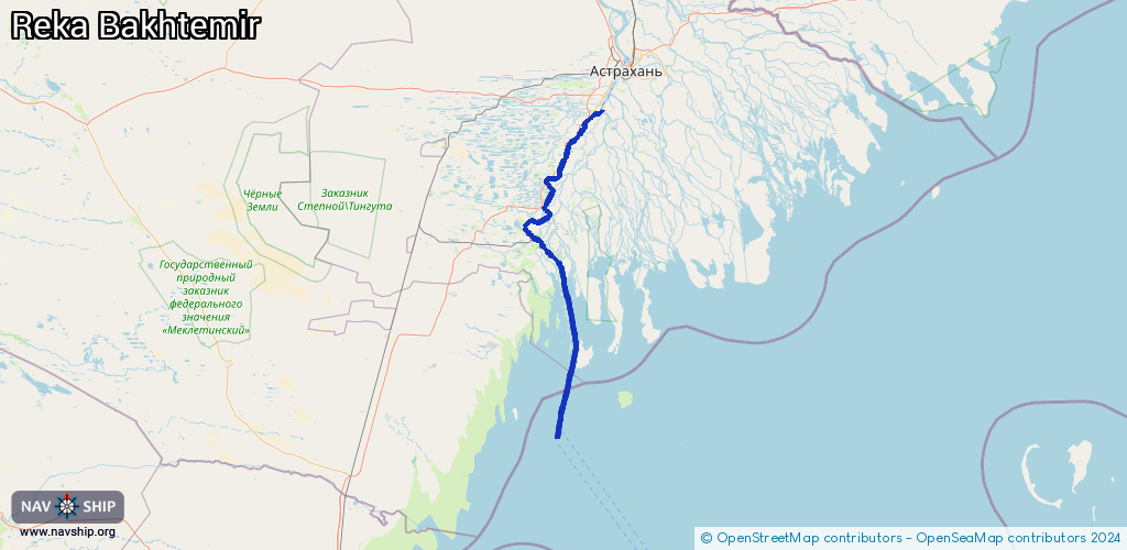
Length:
156.4 km¹
¹River kilometers or bank length recorded in NavShip, including river arms and harbor entrances.
Availability:
Completely recorded
Recent Update: 15.06.2024²
² This date indicates when an adjustment last took place in the course of the body of water
Recorded:
Locks: 0
Harbours / marinas: 0
Bridges: 0
Berths: 15
Slipways: 0
Fuelstations: 0
Route:
Please wait, loading route graphic...
Request waterway overview map with symbol legend here (Link).
Information about data associated with this body of water (15 available):
Data by OpenSeaMap (c) OSM contributors, www.openseamap.org
| # | Kind | Coordinates | Name | Information |
|---|---|---|---|---|
| 1 | Berth | 45.78785,47.54541 | 2022-08-16T22:00:53Z | 10 |
| 2 | Berth | 45.78662,47.54569 | 2022-08-16T22:00:53Z | 10а |
| 3 | Berth | 45.78592,47.54575 | 2022-08-16T22:00:53Z | 10б |
| 4 | Berth | 45.78546,47.54888 | 2022-08-16T22:00:53Z | 5 |
| 5 | Berth | 45.78591,47.54682 | 2022-08-16T22:00:53Z | 5а |
| 6 | Berth | 45.78463,47.54983 | 2022-08-16T22:00:53Z | 4 |
| 7 | Berth | 45.78345,47.55084 | 2022-08-16T22:00:53Z | 3 |
| 8 | Berth | 45.78212,47.55238 | 2022-08-16T22:00:53Z | 1 |
| 9 | Berth | 45.78113,47.55335 | 2022-08-16T22:00:53Z | 2 |
| 10 | Berth | 45.779,47.55593 | 2022-08-16T22:00:53Z | 6а |
| 11 | Berth | 45.77992,47.55511 | 2022-08-16T22:00:53Z | 6 |
| 12 | Berth | 45.77778,47.55718 | 2022-08-16T22:00:53Z | 7 |
| 13 | Berth | 45.77599,47.55922 | 2022-08-16T22:00:53Z | 7а |
| 14 | Berth | 45.77491,47.56049 | 2022-08-16T22:00:53Z | 8 |
| 15 | Berth | 45.77379,47.56152 | 2022-08-16T22:00:53Z | 9 |