Waterway information

Kind:
Inland
Driving areas:
🇷🇺 Russia
Length:
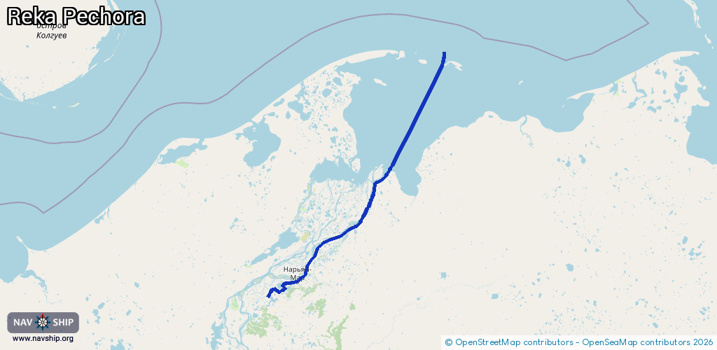
213 km¹
¹River kilometers or bank length recorded in NavShip, including river arms and harbor entrances.
Availability:
Completely recorded
Recent Update: 01.04.2025²
² This date indicates when an adjustment last took place in the course of the body of water
Recorded:
Locks: 0
Harbours / marinas: 1
Bridges: 0
Berths: 13
Slipways: 0
Fuelstations: 0
Route:
Please wait, loading route graphic...
Request waterway overview map with symbol legend here (Link).
Information about data associated with this body of water (14 available):
Data by OpenSeaMap (c) OSM contributors, www.openseamap.org
| # | Kind | Coordinates | Name | Information |
|---|---|---|---|---|
| 1 | Marina | 67.64724,53.00356 | 2025-09-03T22:24:52Z | Порт Нарьян-Мар https://www.mapm.ru/Port/NaryanMar https://upload.wikimedia.org/wikipedia/commons/a/a7/N-mar%2C_view_from_Pechora.jpg |
| 2 | Berth | 68.21007,54.2183 | 2022-07-25T11:49:43Z | № 9 |
| 3 | Berth | 68.1285,54.15539 | 2022-07-25T11:49:43Z | № 8 |
| 4 | Berth | 68.00523,53.96637 | 2022-07-25T11:49:43Z | № 7 |
| 5 | Berth | 67.95156,53.79717 | 2022-07-25T11:49:43Z | № 6 |
| 6 | Berth | 67.7907,53.2443 | 2022-07-25T11:49:43Z | № 5 |
| 7 | Berth | 67.7411,53.1625 | 2022-07-25T11:49:43Z | № 4 |
| 8 | Berth | 67.65313,53.02853 | 2022-07-25T11:49:43Z | № 2 |
| 9 | Berth | 67.64,53.02867 | 2022-07-25T11:49:43Z | № 3 |
| 10 | Berth | 67.64997,53.00836 | 2022-07-25T11:49:43Z | № 1 |
| 11 | Berth | 67.64825,53.00388 | 2022-07-25T14:06:25Z | 4 |
| 12 | Berth | 67.64806,53.00002 | 2022-07-25T14:06:25Z | 3 |
| 13 | Berth | 67.64769,52.99735 | 2022-07-25T14:06:25Z | 2 |
| 14 | Berth | 67.64719,52.99417 | 2022-07-25T14:06:25Z | 1 |