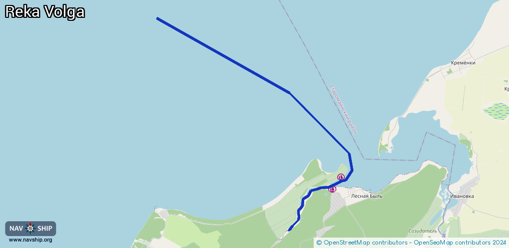
Waterway information

Kind:
Inland
Driving areas:
🇷🇺 Russia
Length:
15.7 km¹
¹River kilometers or bank length recorded in NavShip, including river arms and harbor entrances.
Availability:
Completely recorded
Recent Update: 18.01.2024²
² This date indicates when an adjustment last took place in the course of the body of water
Recorded:
Locks: 0
Harbours / marinas: 2
Bridges: 0
Berths: 0
Slipways: 0
Fuelstations: 0
Route:
Please wait, loading route graphic...
Request waterway overview map with symbol legend here (Link).
Information about data associated with this body of water (2 available):
Data by OpenSeaMap (c) OSM contributors, www.openseamap.org
| # | Kind | Coordinates | Name | Information |
|---|---|---|---|---|
| 1 | Marina | 54.45974,48.78089 | 2021-01-17T07:11:37Z | Нептун +78422671460 |
| 2 | Marina | 54.4647,48.78652 | 2021-01-17T07:11:37Z | Капитан +79372756561 |