Waterway information

Kind:
Inland
Driving areas:
🇳🇱 Netherlands
Length:
2.5 km¹
¹River kilometers or bank length recorded in NavShip, including river arms and harbor entrances.
Availability:
Completely recorded
Recent Update: 29.06.2023²
² This date indicates when an adjustment last took place in the course of the body of water
Recorded:
Locks: 0
Harbours / marinas: 2
Bridges: 2
Berths: 0
Slipways: 1
Fuelstations: 0
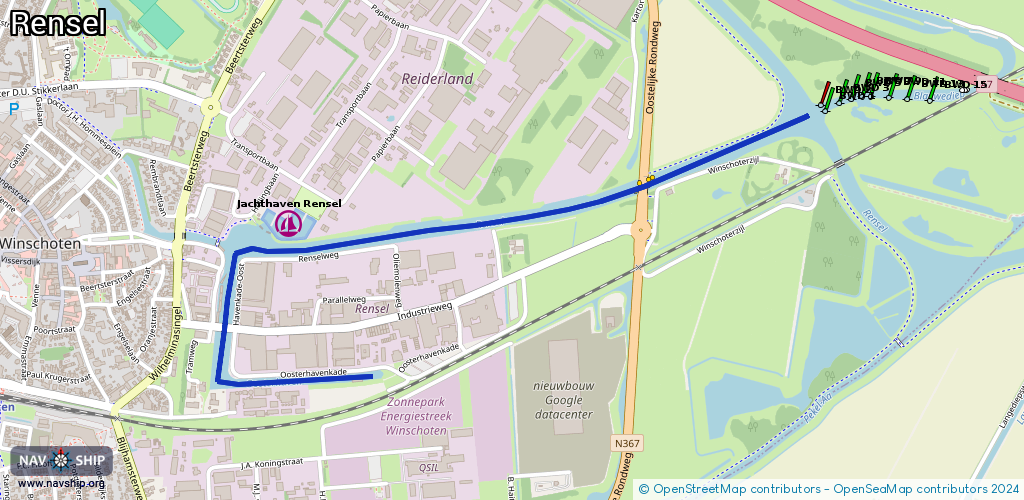
Route:
Please wait, loading route graphic...
Request waterway overview map with symbol legend here (Link).
Information about data associated with this body of water (5 available):
Data by OpenSeaMap (c) OSM contributors, www.openseamap.org
| # | Kind | Coordinates | Name | Information |
|---|---|---|---|---|
| 1 | Marina | 53.14154,7.04581 | 2024-11-05T06:10:57Z | Passantensteiger Winschoten Vor dem Anlegen melden beim Hafenmeister Telefon 06 460 162 91 oder 0597 670190 Wasser und Elektro |
| 2 | Marina | 53.1434,7.04849 | 2025-08-01T20:03:55Z | Jachthaven Winschoten |
| 3 | Bridge | 53.14083,7.04596 | 12 | Clearance height: 2013-02-20T15:25:59Z m Maximum passage width: 1 m Movable bridge (e.g. lifting bridge or drawbridge) opening |
| 4 | Bridge | 53.14451,7.06396 | 12 | Clearance height: 2022-06-05T13:13:39Z m Maximum passage width: 1 m Movable bridge (e.g. lifting bridge or drawbridge) opening VHF 22 |
| 5 | Slipway | 53.1435,7.04737 | small_craft_facility | 2020-06-18T17:49:00Z |