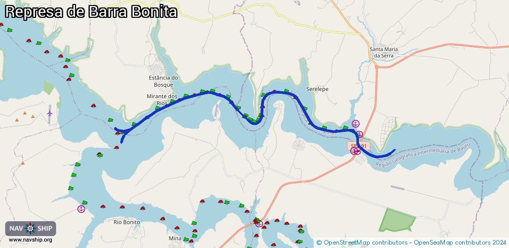
Waterway information

Kind:
Inland
Driving areas:
🇧🇷 Brazil
Length:
25.1 km¹
¹River kilometers or bank length recorded in NavShip, including river arms and harbor entrances.
Availability:
Completely recorded
Recent Update: 07.04.2025²
² This date indicates when an adjustment last took place in the course of the body of water
Recorded:
Locks: 0
Harbours / marinas: 4
Bridges: 0
Berths: 1
Slipways: 0
Fuelstations: 0
Route:
Please wait, loading route graphic...
Request waterway overview map with symbol legend here (Link).
Information about data associated with this body of water (5 available):
Data by OpenSeaMap (c) OSM contributors, www.openseamap.org
| # | Kind | Coordinates | Name | Information |
|---|---|---|---|---|
| 1 | Marina | -22.6323,-48.17529 | 2014-07-01T01:58:20Z | |
| 2 | Marina | -22.63236,-48.17771 | 2014-07-01T01:58:22Z | Porto Areia Tietz |
| 3 | Marina | -22.62161,-48.17405 | 2014-07-01T02:06:14Z | Porto Sartico |
| 4 | Marina | -22.61487,-48.17669 | 2014-07-01T02:07:58Z | Porto de Areia Universal |
| 5 | Berth | -22.61458,-48.1772 | 2014-07-01T20:18:11Z |