Waterway information

Kind:
Inland
Driving areas:
🌊 Atlantic Ocean🇺🇸 United States of America
Length:
35.1 km¹
¹River kilometers or bank length recorded in NavShip, including river arms and harbor entrances.
Availability:
Completely recorded
Recent Update: 11.02.2026²
² This date indicates when an adjustment last took place in the course of the body of water
Recorded:
Locks: 0
Harbours / marinas: 6
Bridges: 0
Berths: 0
Slipways: 0
Fuelstations: 1
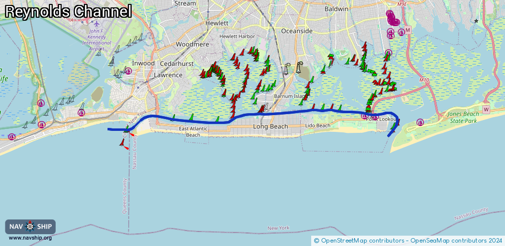
Route:
Please wait, loading route graphic...
Request waterway overview map with symbol legend here (Link).
Information about data associated with this body of water (7 available):
Data by OpenSeaMap (c) OSM contributors, www.openseamap.org
| # | Kind | Coordinates | Name | Information |
|---|---|---|---|---|
| 1 | Marina | 40.60337,-73.73027 | 2025-11-14T03:58:22Z | Lawrence Yacht and Country Club +1-516-239-1685 https://www.lycc.cc/ |
| 2 | Marina | 40.59397,-73.59241 | 2024-05-18T21:36:44Z | West Marina |
| 3 | Marina | 40.59343,-73.58586 | 2020-05-19T21:33:26Z | |
| 4 | Marina | 40.62831,-73.66941 | 2026-01-27T22:13:43Z | Woodmere Bay Yacht Club |
| 5 | Marina | 40.62951,-73.67611 | 2026-01-27T22:13:43Z | Hewlett Point Yacht Club |
| 6 | Marina | 40.62095,-73.69859 | 2026-01-27T21:02:13Z | Keystone Yacht Club |
| 7 | Fuel station | 40.59454,-73.57957 | 2023-06-17T22:14:17Z | Valvitect |