Waterway information

Kind:
Inland
Driving areas:
🇩🇪 Germany
Length:
5.2 km¹
¹River kilometers or bank length recorded in NavShip, including river arms and harbor entrances.
Availability:
Completely recorded
Recent Update: 05.07.2024²
² This date indicates when an adjustment last took place in the course of the body of water
Recorded:
Locks: 0
Harbours / marinas: 2
Bridges: 0
Berths: 0
Slipways: 1
Fuelstations: 1
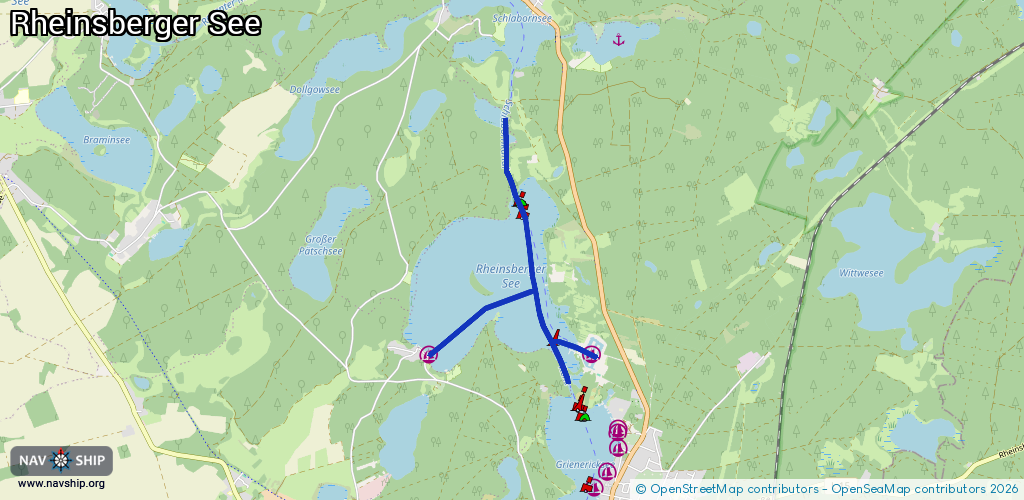
Route:
Please wait, loading route graphic...
Request waterway overview map with symbol legend here (Link).
Information about data associated with this body of water (4 available):
Data by OpenSeaMap (c) OSM contributors, www.openseamap.org
| # | Kind | Coordinates | Name | Information |
|---|---|---|---|---|
| 1 | Marina | 53.11602,12.88808 | 2019-03-13T09:17:34Z | Hafendorf Rheinsberg [email protected] +49 3327 5738091 https://www.rheinsberger-hafendorf.de/ |
| 2 | Marina | 53.11598,12.86016 | 2019-03-05T11:02:13Z | Gast u. Logierhaus [email protected] +49 33931 2131 https://warenthin.de/gasthaus.shtml |
| 3 | Slipway | 53.11448,12.88804 | small_craft_facility | 2023-09-27T17:09:14Z |
| 4 | Fuel station | 53.11468,12.88722 | 2015-12-14T17:35:45Z |