Waterway information

Kind:
Inland
Driving areas:
🇦🇷 Argentina
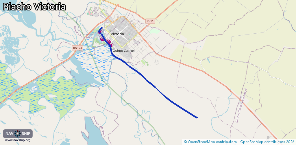
Length:
15.4 km¹
¹River kilometers or bank length recorded in NavShip, including river arms and harbor entrances.
Availability:
Completely recorded
Recent Update: 05.11.2024²
² This date indicates when an adjustment last took place in the course of the body of water
Recorded:
Locks: 0
Harbours / marinas: 5
Bridges: 0
Berths: 0
Slipways: 0
Fuelstations: 0
Route:
Please wait, loading route graphic...
Request waterway overview map with symbol legend here (Link).
Information about data associated with this body of water (5 available):
Data by OpenSeaMap (c) OSM contributors, www.openseamap.org
| # | Kind | Coordinates | Name | Information |
|---|---|---|---|---|
| 1 | Marina | -32.63264,-60.16508 | 2025-08-04T00:32:27Z | Guardería Náutica DAPSA |
| 2 | Marina | -32.62976,-60.16829 | 2020-12-07T19:55:10Z | Club de Pescadores |
| 3 | Marina | -32.62859,-60.16929 | 2020-12-07T19:55:10Z | |
| 4 | Marina | -32.62694,-60.17537 | 2020-12-07T19:55:10Z | |
| 5 | Marina | -32.6196,-60.17806 | 2020-12-07T19:55:10Z |