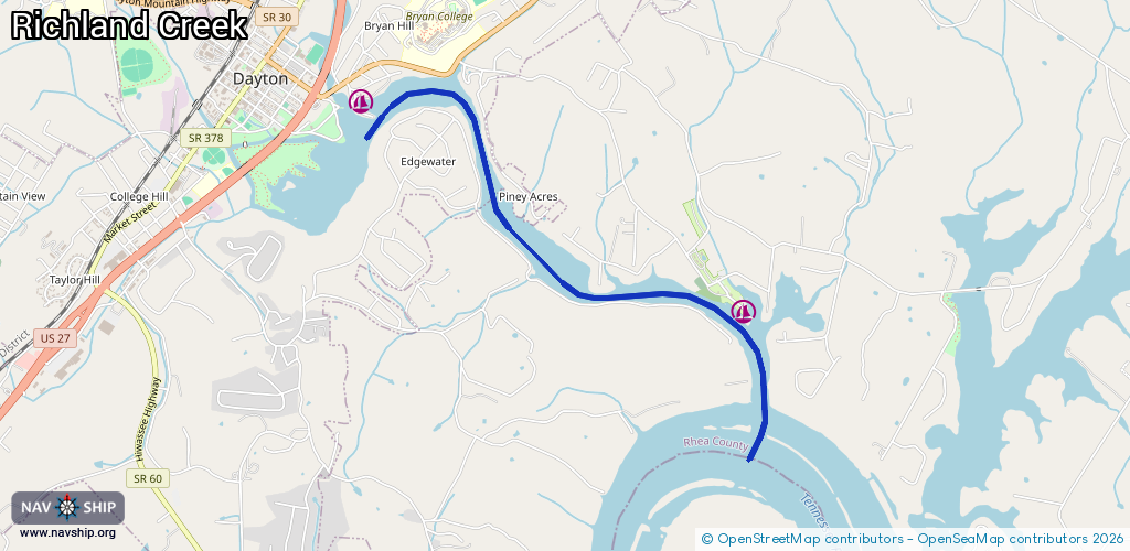
Waterway information

Kind:
Inland
Driving areas:
🇺🇸 United States of America
Length:
4.7 km¹
¹River kilometers or bank length recorded in NavShip, including river arms and harbor entrances.
Availability:
Completely recorded
Recent Update: 19.12.2023²
² This date indicates when an adjustment last took place in the course of the body of water
Recorded:
Locks: 0
Harbours / marinas: 2
Bridges: 0
Berths: 0
Slipways: 0
Fuelstations: 1
Route:
Please wait, loading route graphic...
Request waterway overview map with symbol legend here (Link).
Information about data associated with this body of water (3 available):
Data by OpenSeaMap (c) OSM contributors, www.openseamap.org
| # | Kind | Coordinates | Name | Information |
|---|---|---|---|---|
| 1 | Marina | 35.49244,-85.00465 | 2023-11-17T15:18:55Z | |
| 2 | Marina | 35.47913,-84.97491 | 2025-11-09T12:07:51Z | Blue Water Resort [email protected] +1-423-775-3265 https://bluewaterdayton.com/ |
| 3 | Fuel station | 35.47902,-84.97537 | 2025-01-20T18:58:41Z |