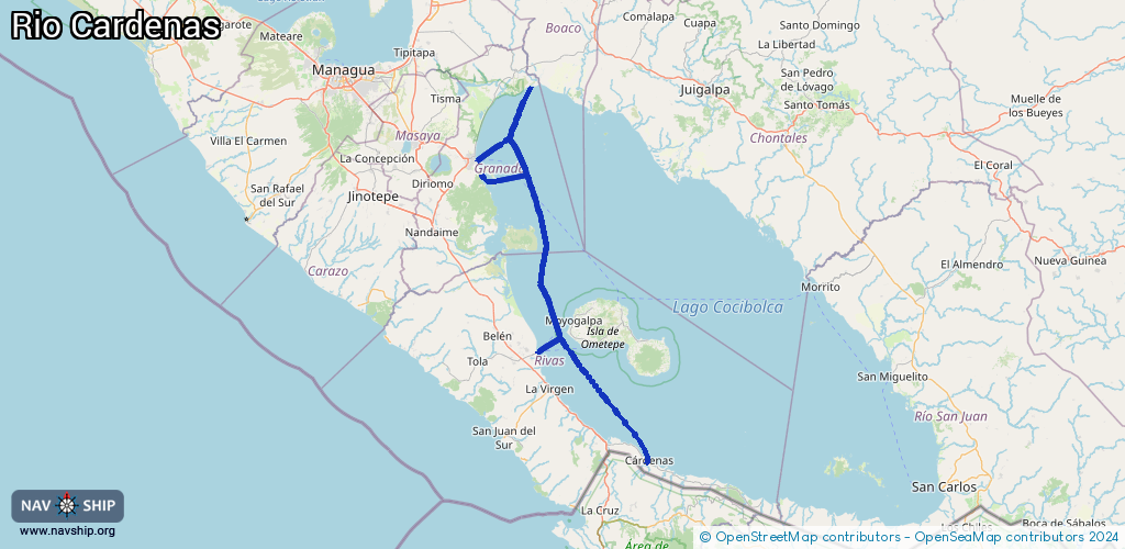
Waterway information

Kind:
Inland
Driving areas:
🇳🇮 Nicaragua
Length:
146.6 km¹
¹River kilometers or bank length recorded in NavShip, including river arms and harbor entrances.
Availability:
Completely recorded
Recent Update: 23.09.2024²
² This date indicates when an adjustment last took place in the course of the body of water
Recorded:
Locks: 0
Harbours / marinas: 4
Bridges: 1
Berths: 0
Slipways: 0
Fuelstations: 0
Route:
Please wait, loading route graphic...
Request waterway overview map with symbol legend here (Link).
Information about data associated with this body of water (5 available):
Data by OpenSeaMap (c) OSM contributors, www.openseamap.org
| # | Kind | Coordinates | Name | Information |
|---|---|---|---|---|
| 1 | Marina | 11.46086,-85.78961 | 2024-01-16T18:49:40Z | Muelle de San Jorge |
| 2 | Marina | 11.46165,-85.78916 | 2024-01-16T18:49:40Z | Puerto Lacustre de San Jorge |
| 3 | Marina | 11.88274,-85.89643 | 2025-11-21T16:58:24Z | Puerto El Rayo |
| 4 | Marina | 11.93066,-85.9422 | 2026-02-16T20:01:03Z | Puerto de Granada |
| 5 | Bridge | 11.1917,-85.51733 | Unknown | Clearance height: 2017-12-28T20:37:47Z m Movable bridge (e.g. lifting bridge or drawbridge) |