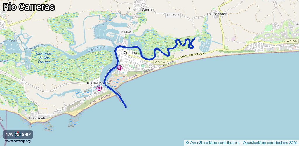
Waterway information

Kind:
Inland
Driving areas:
🌊 Atlantic Ocean🇪🇸 Spain
Length:
11.1 km¹
¹River kilometers or bank length recorded in NavShip, including river arms and harbor entrances.
Availability:
Completely recorded
Recent Update: 04.01.2024²
² This date indicates when an adjustment last took place in the course of the body of water
Recorded:
Locks: 0
Harbours / marinas: 2
Bridges: 0
Berths: 0
Slipways: 0
Fuelstations: 0
Route:
Please wait, loading route graphic...
Request waterway overview map with symbol legend here (Link).
Information about data associated with this body of water (2 available):
Data by OpenSeaMap (c) OSM contributors, www.openseamap.org
| # | Kind | Coordinates | Name | Information |
|---|---|---|---|---|
| 1 | Marina | 37.19669,-7.32846 | 2023-04-17T07:01:24Z | Puerto Deportivo de Isla Cristina |
| 2 | Marina | 37.18683,-7.33996 | 2023-04-17T07:01:24Z | Marina Isla Canela https://www.marina-islacanela.com |