Waterway information

Kind:
Inland
Driving areas:
🌊 Atlantic Ocean🇪🇸 Spain
Length:
24.3 km¹
¹River kilometers or bank length recorded in NavShip, including river arms and harbor entrances.
Availability:
Completely recorded
Recent Update: 27.12.2025²
² This date indicates when an adjustment last took place in the course of the body of water
Recorded:
Locks: 0
Harbours / marinas: 6
Bridges: 0
Berths: 0
Slipways: 0
Fuelstations: 0
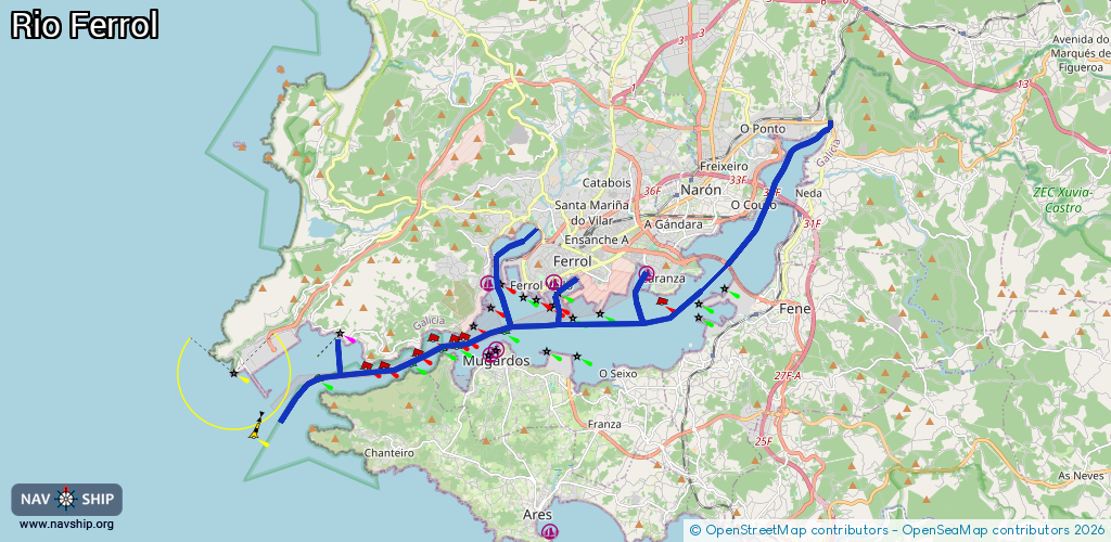
Route:
Please wait, loading route graphic...
Request waterway overview map with symbol legend here (Link).
Information about data associated with this body of water (6 available):
Data by OpenSeaMap (c) OSM contributors, www.openseamap.org
| # | Kind | Coordinates | Name | Information |
|---|---|---|---|---|
| 1 | Marina | 43.48174,-8.20947 | 2025-02-13T23:46:26Z | Caranza |
| 2 | Marina | 43.46292,-8.259 | 2025-01-04T15:02:29Z | Porto de Mugardos |
| 3 | Marina | 43.46441,-8.25691 | 2024-01-25T09:54:30Z | Peirao de Mugardos |
| 4 | Marina | 43.47939,-8.25994 | 2022-03-14T09:34:21Z | Peirao da Graña |
| 5 | Marina | 43.46797,-8.30651 | 2024-06-14T13:18:11Z | Baliza de San Cristovo |
| 6 | Marina | 43.47961,-8.23891 | 2025-12-17T18:03:57Z | Porto Chico |