Waterway information

Kind:
Inland
Driving areas:
🌊 Atlantic Ocean🇪🇸 Spain
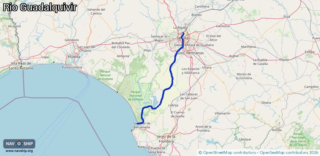
Length:
97.1 km¹
¹River kilometers or bank length recorded in NavShip, including river arms and harbor entrances.
Availability:
Completely recorded
Recent Update: 22.06.2023²
² This date indicates when an adjustment last took place in the course of the body of water
Recorded:
Locks: 1
Harbours / marinas: 3
Bridges: 0
Berths: 0
Slipways: 2
Fuelstations: 0
Route:
Please wait, loading route graphic...
Request waterway overview map with symbol legend here (Link).
Information about data associated with this body of water (5 available):
Data by OpenSeaMap (c) OSM contributors, www.openseamap.org
| # | Kind | Coordinates | Name | Information |
|---|---|---|---|---|
| 1 | Marina | 37.36293,-5.99104 | 2022-12-29T10:15:42Z | Puerto de Sevilla http://www.apsevilla.com |
| 2 | Marina | 37.35435,-5.99433 | 2016-07-29T04:08:25Z | Sevilla |
| 3 | Marina | 36.83513,-6.35811 | 2025-05-10T14:22:49Z | Real Fernando Boat |
| 4 | Slipway | 37.36856,-5.99419 | small_craft_facility | 2016-07-29T04:08:26Z |
| 5 | Slipway | 37.36859,-5.99416 | small_craft_facility | 2016-07-29T04:08:26Z |
| 5 | Slipway | 37.36859,-5.99416 | small_craft_facility | 2016-07-29T04:08:26Z |