Waterway information

Kind:
Inland
Driving areas:
🇧🇷 Brazil
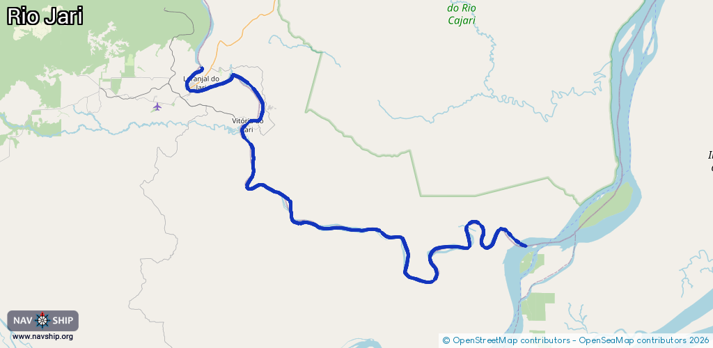
Length:
147.1 km¹
¹River kilometers or bank length recorded in NavShip, including river arms and harbor entrances.
Availability:
Completely recorded
Recent Update: 30.09.2024²
² This date indicates when an adjustment last took place in the course of the body of water
Recorded:
Locks: 0
Harbours / marinas: 3
Bridges: 0
Berths: 1
Slipways: 0
Fuelstations: 0
Route:
Please wait, loading route graphic...
Request waterway overview map with symbol legend here (Link).
Information about data associated with this body of water (4 available):
Data by OpenSeaMap (c) OSM contributors, www.openseamap.org
| # | Kind | Coordinates | Name | Information |
|---|---|---|---|---|
| 1 | Marina | -0.85765,-52.53516 | 2015-07-02T11:36:02Z | Laranjal do Jari |
| 2 | Marina | -0.92464,-52.42475 | 2015-07-02T11:36:02Z | Vitória do Jari |
| 3 | Marina | -0.92904,-52.43418 | 2015-07-02T11:36:02Z | Munguba Almeirim |
| 4 | Berth | -0.91808,-52.42362 | 2015-08-21T09:27:06Z | Porto de Munguba |