Waterway information

Kind:
Inland
Driving areas:
🌊 Atlantic Ocean🇪🇸 Spain
Length:
14 km¹
¹River kilometers or bank length recorded in NavShip, including river arms and harbor entrances.
Availability:
Completely recorded
Recent Update: 11.05.2023²
² This date indicates when an adjustment last took place in the course of the body of water
Recorded:
Locks: 0
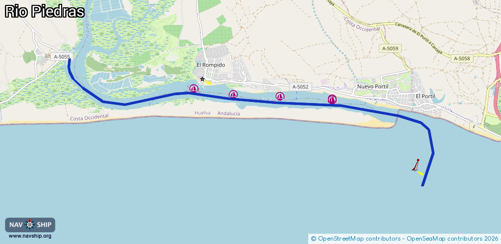
Harbours / marinas: 5
Bridges: 0
Berths: 0
Slipways: 0
Fuelstations: 0
Route:
Please wait, loading route graphic...
Request waterway overview map with symbol legend here (Link).
Information about data associated with this body of water (5 available):
Data by OpenSeaMap (c) OSM contributors, www.openseamap.org
| # | Kind | Coordinates | Name | Information |
|---|---|---|---|---|
| 1 | Marina | 37.21585,-7.12975 | 2020-01-22T22:38:02Z | Puerto Marina El Rompido |
| 2 | Marina | 37.21424,-7.1159 | 2020-01-22T22:16:23Z | Club Náutico Río Piedras |
| 3 | Marina | 37.21373,-7.09954 | 2021-06-28T18:30:36Z | |
| 4 | Marina | 37.21294,-7.08122 | 2021-06-28T18:30:36Z | |
| 5 | Marina | 37.21286,-7.08154 | 2024-09-20T18:50:38Z | Marina Nuevo Portil |