Waterway information

Kind:
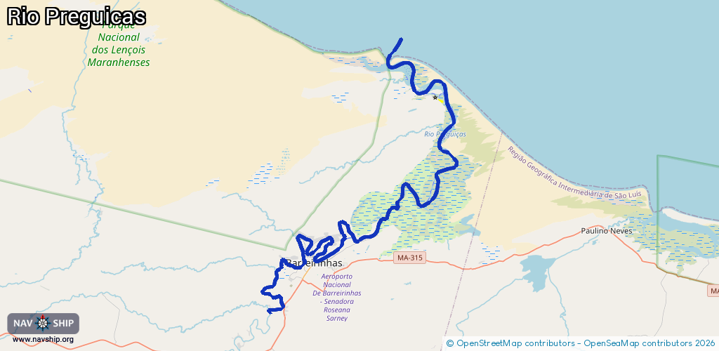
Inland
Driving areas:
🌊 Atlantic Ocean🇧🇷 Brazil
Length:
79.3 km¹
¹River kilometers or bank length recorded in NavShip, including river arms and harbor entrances.
Availability:
Completely recorded
Recent Update: 17.10.2024²
² This date indicates when an adjustment last took place in the course of the body of water
Recorded:
Locks: 0
Harbours / marinas: 3
Bridges: 0
Berths: 0
Slipways: 0
Fuelstations: 1
Route:
Please wait, loading route graphic...
Request waterway overview map with symbol legend here (Link).
Information about data associated with this body of water (4 available):
Data by OpenSeaMap (c) OSM contributors, www.openseamap.org
| # | Kind | Coordinates | Name | Information |
|---|---|---|---|---|
| 1 | Marina | -2.73747,-42.83868 | 2021-01-06T22:34:12Z | Marina do Porto Preguiças Resort |
| 2 | Marina | -2.74157,-42.81673 | 2021-01-13T02:01:14Z | |
| 3 | Marina | -2.7423,-42.80452 | 2021-01-06T22:34:12Z | Marina do Gran Lençóis Flat Residence |
| 4 | Fuel station | -2.7456,-42.82325 | 2025-12-30T13:26:39Z | Posto BR |