Waterway information

Kind:
Inland
Driving areas:
🇨🇱 Chile🌊 Pacific Ocean
Length:
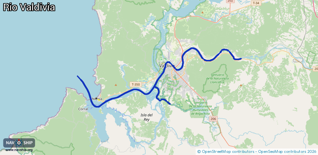
51 km¹
¹River kilometers or bank length recorded in NavShip, including river arms and harbor entrances.
Availability:
Completely recorded
Recent Update: 08.04.2025²
² This date indicates when an adjustment last took place in the course of the body of water
Recorded:
Locks: 0
Harbours / marinas: 4
Bridges: 0
Berths: 0
Slipways: 0
Fuelstations: 0
Route:
Please wait, loading route graphic...
Request waterway overview map with symbol legend here (Link).
Information about data associated with this body of water (4 available):
Data by OpenSeaMap (c) OSM contributors, www.openseamap.org
| # | Kind | Coordinates | Name | Information |
|---|---|---|---|---|
| 1 | Marina | -39.87521,-73.24445 | 2024-09-10T00:46:34Z | The Roaring Forties Marina +56951858375 https://roaringfortiesmarina.com/ |
| 2 | Marina | -39.81527,-73.24924 | 2023-04-10T15:06:02Z | Puerto Solar Valdivia |
| 3 | Marina | -39.8244,-73.25092 | 2024-02-07T00:59:38Z | Club de Yates Valdivia +56 63 2213028 https://www.cyv.cl/ |
| 4 | Marina | -39.84841,-73.31699 | 2021-07-07T19:44:32Z | Marina Estancilla +56 63 2213028 |