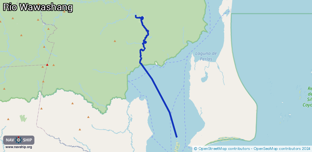
Waterway information

Kind:
Inland
Driving areas:
🌊 Atlantic Ocean🇳🇮 Nicaragua
Length:
39.4 km¹
¹River kilometers or bank length recorded in NavShip, including river arms and harbor entrances.
Availability:
Completely recorded
Recent Update: 23.09.2024²
² This date indicates when an adjustment last took place in the course of the body of water
Recorded:
Locks: 0
Harbours / marinas: 1
Bridges: 0
Berths: 2
Slipways: 1
Fuelstations: 0
Route:
Please wait, loading route graphic...
Request waterway overview map with symbol legend here (Link).
Information about data associated with this body of water (4 available):
Data by OpenSeaMap (c) OSM contributors, www.openseamap.org
| # | Kind | Coordinates | Name | Information |
|---|---|---|---|---|
| 1 | Marina | 12.6595,-83.7603 | 2017-08-29T17:15:46Z | |
| 2 | Slipway | 12.6472,-83.74658 | small_craft_facility | 2017-08-31T08:06:08Z |
| 3 | Berth | 12.64213,-83.74508 | 2017-08-29T16:43:30Z | small_craft |
| 4 | Berth | 12.64395,-83.74471 | 2017-08-29T16:43:29Z |