Waterway information

Kind:
Inland
Driving areas:
🌊 North Sea🇬🇧 United Kingdom
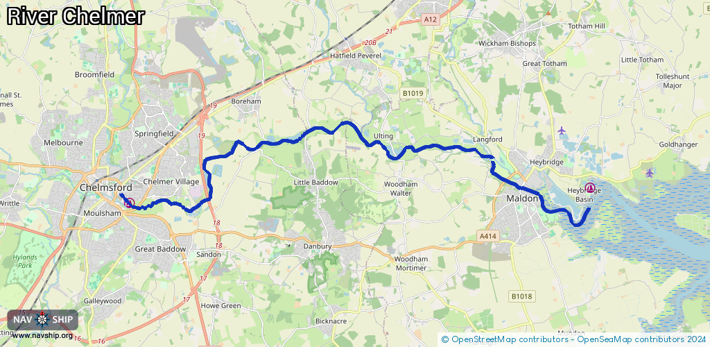
Length:
21.9 km¹
¹River kilometers or bank length recorded in NavShip, including river arms and harbor entrances.
Availability:
Completely recorded
Recent Update: 05.01.2024²
² This date indicates when an adjustment last took place in the course of the body of water
Recorded:
Locks: 10
Harbours / marinas: 1
Bridges: 0
Berths: 0
Slipways: 0
Fuelstations: 0
Route:
Please wait, loading route graphic...
Request waterway overview map with symbol legend here (Link).
Information about data associated with this body of water (10 available):
Data by OpenSeaMap (c) OSM contributors, www.openseamap.org
| # | Kind | Coordinates | Name | Information |
|---|---|---|---|---|
| 1 | Marina | 51.72962,0.48464 | 2020-08-04T09:23:53Z | Lockside Marina |
| 1 | Marina | 51.72962,0.48464 | 2020-08-04T09:23:53Z | Lockside Marina |
| 2 | Lock | 51.74401,0.66231 | Beeleigh Lock | |
| 3 | Lock | 51.74677,0.64429 | Ricketts Lock | |
| 4 | Lock | 51.74352,0.6172 | Hoe Mill Lock | |
| 5 | Lock | 51.75112,0.57161 | Paper Mill Lock | |
| 6 | Lock | 51.74647,0.54698 | Little Baddow Mill Lock | |
| 7 | Lock | 51.74516,0.53493 | Stonhams Lock | |
| 8 | Lock | 51.7393,0.5229 | Cuton Lock | |
| 9 | Lock | 51.73035,0.49945 | Barnes Mill Lock | |
| 10 | Lock | 51.72907,0.485 | Springfield Lock |