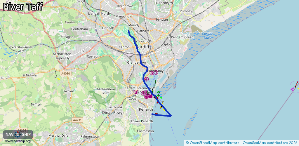
Waterway information

Kind:
Inland
Driving areas:
🌊 Atlantic Ocean🇬🇧 United Kingdom
Length:
10.1 km¹
¹River kilometers or bank length recorded in NavShip, including river arms and harbor entrances.
Availability:
Completely recorded
Recent Update: 25.09.2023²
² This date indicates when an adjustment last took place in the course of the body of water
Recorded:
Locks: 1
Harbours / marinas: 3
Bridges: 0
Berths: 0
Slipways: 2
Fuelstations: 0
Route:
Please wait, loading route graphic...
Request waterway overview map with symbol legend here (Link).
Information about data associated with this body of water (6 available):
Data by OpenSeaMap (c) OSM contributors, www.openseamap.org
| # | Kind | Coordinates | Name | Information |
|---|---|---|---|---|
| 1 | Marina | 51.46264,-3.16347 | 2024-07-11T17:17:57Z | Mermaid Quay Pay & Display |
| 2 | Marina | 51.4621,-3.16815 | 2021-09-30T14:27:39Z | Graving Dock Pay & Display |
| 3 | Marina | 51.45808,-3.17425 | 2025-03-28T11:06:50Z | Cardiff Yacht Club |
| 4 | Slipway | 51.43223,-3.16841 | small_craft_facility | 2021-01-08T13:04:36Z |
| 5 | Slipway | 51.43239,-3.16836 | small_craft_facility | 2024-06-15T02:37:16Z |
| 6 | Lock | 51.44635,-3.16611 | Unknown |