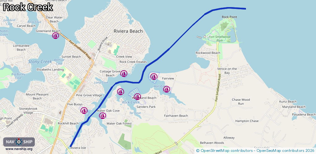
Waterway information

Kind:
Inland
Driving areas:
🌊 Atlantic Ocean🇺🇸 United States of America
Length:
5.8 km¹
¹River kilometers or bank length recorded in NavShip, including river arms and harbor entrances.
Availability:
Completely recorded
Recent Update: 17.06.2025²
² This date indicates when an adjustment last took place in the course of the body of water
Recorded:
Locks: 0
Harbours / marinas: 7
Bridges: 0
Berths: 0
Slipways: 0
Fuelstations: 0
Route:
Please wait, loading route graphic...
Request waterway overview map with symbol legend here (Link).
Information about data associated with this body of water (7 available):
Data by OpenSeaMap (c) OSM contributors, www.openseamap.org
| # | Kind | Coordinates | Name | Information |
|---|---|---|---|---|
| 1 | Marina | 39.14691,-76.51877 | 2020-05-19T21:33:26Z | |
| 2 | Marina | 39.14577,-76.5135 | 2020-05-19T21:33:26Z | |
| 3 | Marina | 39.1508,-76.50882 | 2020-05-19T21:33:26Z | |
| 4 | Marina | 39.15496,-76.50811 | 2020-05-19T21:33:26Z | |
| 5 | Marina | 39.14953,-76.50352 | 2025-07-21T16:22:45Z | WhiteRocks Marina & Boatyard |
| 6 | Marina | 39.15141,-76.49547 | 2025-07-21T16:22:45Z | Fairview Marina |
| 7 | Marina | 39.1543,-76.49959 | 2023-07-20T16:35:29Z | Maryland Yacht Club |