Waterway information

Kind:
Inland
Driving areas:
🇩🇪 Germany
Length:
1.3 km¹
¹River kilometers or bank length recorded in NavShip, including river arms and harbor entrances.
Availability:
Completely recorded
Recent Update: 29.08.2023²
² This date indicates when an adjustment last took place in the course of the body of water
Recorded:
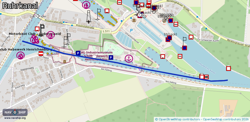
Locks: 0
Harbours / marinas: 3
Bridges: 1
Berths: 1
Slipways: 0
Fuelstations: 0
Route:
Please wait, loading route graphic...
Request waterway overview map with symbol legend here (Link).
Information about data associated with this body of water (5 available):
Data by OpenSeaMap (c) OSM contributors, www.openseamap.org
| # | Kind | Coordinates | Name | Information |
|---|---|---|---|---|
| 1 | Marina | 51.61746,7.32276 | 2025-09-17T21:46:06Z | Motorboot Club - Lüdenscheid 08:00-22:00 [email protected] +49 174 1608039 https://www.mcl-luedenscheid.de/ |
| 2 | Marina | 51.61771,7.32421 | 2025-09-12T20:50:35Z | |
| 3 | Marina | 51.61644,7.33102 | 2014-06-16T14:34:48Z | |
| 4 | Bridge | 51.61588,7.3324 | Unknown | Clearance height: 2012-09-24T16:17:42Z m fixed |
| 5 | Berth | 51.61655,7.32792 | 2018-06-22T16:39:16Z |