Waterway information

Kind:
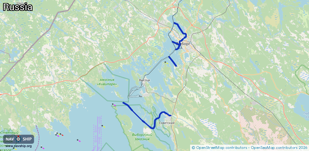
Inland
Driving areas:
🇷🇺 Russia
Length:
32.3 km¹
¹River kilometers or bank length recorded in NavShip, including river arms and harbor entrances.
Availability:
Completely recorded
Recent Update: 23.06.2025²
² This date indicates when an adjustment last took place in the course of the body of water
Recorded:
Locks: 0
Harbours / marinas: 3
Bridges: 0
Berths: 4
Slipways: 0
Fuelstations: 0
Route:
Please wait, loading route graphic...
Request waterway overview map with symbol legend here (Link).
Information about data associated with this body of water (7 available):
Data by OpenSeaMap (c) OSM contributors, www.openseamap.org
| # | Kind | Coordinates | Name | Information |
|---|---|---|---|---|
| 1 | Marina | 60.71727,28.7485 | 2025-08-10T15:10:44Z | Причал №15 |
| 2 | Marina | 60.73118,28.74287 | 2023-08-26T21:01:40Z | Пристань Two Castles |
| 3 | Marina | 60.65916,28.7133 | 2024-07-14T10:09:25Z | База отдыха Соколинское |
| 4 | Berth | 60.54617,28.64667 | 2022-08-17T19:51:16Z | 2 |
| 5 | Berth | 60.55233,28.63733 | 2022-08-17T19:51:16Z | 1 |
| 6 | Berth | 60.55022,28.64579 | 2022-08-17T19:51:16Z | Внутренний рейд удаленного морского терминала |
| 7 | Berth | 60.55617,28.65317 | 2022-08-17T19:51:16Z | 4 |